Wikipedia:Graphics Lab/Map workshop/Archive/Mar 2026
 | This is an archive of past discussions on Wikipedia:Graphics Lab, for the period 2026. Do not edit the contents of this page. If you wish to start a new discussion or revive an old one, please do so on the current main page. |
 | Archives of 2026:
January, February, March, April, May, June, July, August, September, October, November, December |
Medieval Peloponnese
I am intending to nominate the article on Nerio I Acciaioli for FAR. During the peer review, one reviewer observed that the current map is of limited assistance, as it does not sufficiently highlight several principal locations discussed in the text. I would be grateful if you could revise the map to indicate, using appropriate symbols and colour, the following settlements:
- Argos
- Athens
- Corinth
- Megara
- Nauplia
- Patras
- Thebes
- Vostitsa (Aigio)
I would also be grateful if the following regions could be distinguished by colour:
- Attica
- Boeotia
- Euboea (Negroponte)
The map is the following:

Many thanks in advance for your time and assistance. Borsoka (talk) 03:26, 8 March 2026 (UTC)
Romani flag maps - Spain
{{resolved}}
-

 Done
Done -
 Done
Done -
 Done
Done -
 Done
Done -
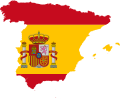 This can be used as a template in the creation of both files.
 -
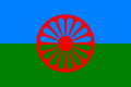 Standard Romani flag, which could be used in the creation of the first file.
 -
 "Gypsy colours of Spain", which could be used in the creation of the second file.
 -
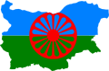 Romani flag map for Bulgaria, provided as an example.
 -
 Romani flag map for Romania, also as an example.
.svg)
.svg)
.svg)
.svg)


.svg)
.svg)
- Article(s)
- Anywhere where flag maps may be relevent.
- Request
- Could someone please create two new flag maps representing the Romani population of Spain, with the first one depicting the standard Romani flag and the second one depicting the so-called "Gypsy colours of Spain"? Thanks. Snow Lion Fenian (talk) 23:10, 11 April 2026 (UTC)
- Discussion

- @Snow Lion Fenian: Note that the Canary Islands are missing in your example – compare with this thumbnail. cmɢʟee τaʟκ (please add
{{ping|cmglee}}to your reply) 16:55, 23 April 2026 (UTC)- @Cmglee: Thanks for that. With that in mind, I now think it may be better to create two flag maps for each of the two flags, one with the Canary Islands and one without them. Snow Lion Fenian (talk) 12:06, 24 April 2026 (UTC)
- @Cmglee: Thank you for creating the files! Although perhaps you could crop the unnecessary additional transparent space on the left and right sides of all four maps? Snow Lion Fenian (talk) 00:52, 27 April 2026 (UTC)
- @Snow Lion Fenian: My pleasure. I made the aspect ratio 3:2 as of the original flag. If you want another value, change the viewBox accordingly e.g.
viewBox="0 0 686 500". cmɢʟee τaʟκ (please add{{ping|cmglee}}to your reply) 05:58, 27 April 2026 (UTC)- @Cmglee: Oh, I see! Perhaps you could explain exactly how I could go about doing that? Snow Lion Fenian (talk) 19:05, 28 April 2026 (UTC)
- @Snow Lion Fenian: Taking File:Flag_map_of_Spain_(Romani_people).svg as example:
- Download its SVG file: http://upload.wikimedia.org/wikipedia/commons/f/f3/Flag_map_of_Spain_%28Romani_people%29.svg
- Open it in a text editor
- On the second line, modify the values after viewBox accordingly (a good start is "0 0 686 500")
- Open it in a web browser
- Repeat above two steps until you're satisfied
- Upload it to https://commons.wikimedia.org/w/index.php?title=Special:Upload&wpDestFile=Flag_map_of_Spain_%28Romani_people%29.svg&wpForReUpload=1
- Good luck, cmɢʟee τaʟκ (please add
{{ping|cmglee}}to your reply) 08:05, 29 April 2026 (UTC)- @Cmglee: Noted, and thanks again for all your help! Snow Lion Fenian (talk) 13:52, 29 April 2026 (UTC)
- @Snow Lion Fenian: Taking File:Flag_map_of_Spain_(Romani_people).svg as example:
- @Cmglee: Oh, I see! Perhaps you could explain exactly how I could go about doing that? Snow Lion Fenian (talk) 19:05, 28 April 2026 (UTC)
- @Snow Lion Fenian: My pleasure. I made the aspect ratio 3:2 as of the original flag. If you want another value, change the viewBox accordingly e.g.
Request: Map of the Nile river
-
 Good: Correct area, topo coloring, absence of text labels, presence of country boundaries, drainage basin shown. Bad: border, low resolution.
 -
 Good: Correct area; Bad: border, low resolution, drainage basin shown.; flat coloring.
 -
 Good: correct area; Bad: textual labels; River basin not delineated (with color change).


- Article(s)
- Nile River
- Request
- I'm working on the Nile River article, planning to get it to WP:Featured Article status. Of course, a great map is required. I've hunted in Wiki Commons, but cannot find a decent map. The closest I can find are the three images displayed above ... but none of them are great.
I only need one map. I'm displaying three example maps above as examples of "close, but not great".
The desired map would be similar to the first (left) map shown above, with these improvements:
- Higher resolution: about 1,000 x 3,000 pixels
- Eliminate the border region around the perimeter (with lat/long numbers) ... not needed
Things about the first map that are great and should be retained:
- Topographic (elevation) coloring inside the Nile basin
- Emphasize the Nile River drainage basin by changing color scheme inside/outside the basin
- Nile river (and its lakes) must prominently displayed in a bold blue color
- No textual labels at all on the map
- National boundary lines (should be fairly faint)
Things about the first map that _could_ be changed if it helps the graphist/cartographer:
- Okay to change the topo/elevation coloring to another scheme
- Okay to eliminate the elevation/topo legend/key
Thanks so much for any help you can provide!!! -- Noleander (talk) 04:23, 28 January 2026 (UTC)
- Discussion
- I'm looking into this. M.Bitton (talk) 21:46, 28 January 2026 (UTC)
- @Noleander: when do you need it by? M.Bitton (talk) 13:56, 11 February 2026 (UTC)
- @M.Bitton - I plan on nominating the Nile article for Featured Article status in April/May. So having the map in mid-March should give me time to place annotations on top of it (dams, cataracts, tourist sights, etc) in time for the FA nomination. I don't need help with placing annotations on top: I just need a hi-resolution background map (as described above). Any help you can give would be appreciated! Noleander (talk) 14:00, 11 February 2026 (UTC)
 Request taken by M.Bitton (talk) 15:12, 11 February 2026 (UTC).
- @M.Bitton - Another editor spontaneously created a map for the Nile article, so this request can be closed. If you invested any time starting to build a Nile map, I apologize ...but it would not be wasted time: The article is large, and will need about four maps before I can take it to WP:FA, so if you have a partially completed map, I'm happy to take it and make it work. Thanks for offering to help ... much appreciated! Noleander (talk) 18:05, 26 February 2026 (UTC)
- @Noleander: I'll notify you when it's finished. M.Bitton (talk) 21:50, 26 February 2026 (UTC)
- Roger. Noleander (talk) 23:33, 26 February 2026 (UTC)
- @M.Bitton - I've completed my work on the body text of the Nile article, so I'm posting the Featured Article nomination today. It is best to start the nomination now, while all the topic sources are fresh in my mind. The article has some decent maps, but it certainly would be improved by incorporating more and better maps. The FAC nomination will take about 2 months, and the article will undergo lots of modifications during that time. If any new maps become available, the article definitely can and will use them. Thanks! Noleander (talk) 22:20, 19 March 2026 (UTC)
- @Noleander: I'll notify you when it's finished. M.Bitton (talk) 21:50, 26 February 2026 (UTC)
- @M.Bitton - Another editor spontaneously created a map for the Nile article, so this request can be closed. If you invested any time starting to build a Nile map, I apologize ...but it would not be wasted time: The article is large, and will need about four maps before I can take it to WP:FA, so if you have a partially completed map, I'm happy to take it and make it work. Thanks for offering to help ... much appreciated! Noleander (talk) 18:05, 26 February 2026 (UTC)

Help regarding distance map creation
This map is available on the official website of UT of Lakshadweep. https://lakshadweep.gov.in/about-lakshadweep/lakshadweep-map/ Since this cannot be uploaded to Wikipedia under fair use, can someone (probably, Inkscape experts) create a free equivalent and upload to Wikimedia?
Anish Viswa 06:08, 27 February 2026 (UTC)
- @Anishviswa: Is it necessary to have such a map? Will a table of distances (and bearing if needed) suffice? cmɢʟee τaʟκ (please add
{{ping|cmglee}}to your reply) 15:14, 20 March 2026 (UTC)- A map will be a better representation than a table.
Anish Viswa 04:40, 23 March 2026 (UTC)
- A map will be a better representation than a table.
Yemen

-
 Northern Yemen
 -
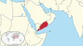 Southern Yemen
 -
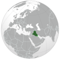 Orthographic projection of Middle East in the 90's


- Article(s)
- South Yemen and Yemen Arab Republic.
- Request
- Hi. I need two svg orthographic projections for South Yemen and Yemen Arab Republic. Both should have etheir northern or southern Yemen in light green, as territory claimed. Like for Ba'athist Syria for example. CC @Abo Yemen:. -- Panam2014 (talk) 12:59, 10 January 2026 (UTC)
- Thanks for the ping. I would also like to request a map of South Yemen showing the w:Kamaran island being part of it, per w:South Yemen#Territorial changes 𐩣𐩫𐩧𐩨 Abo Yemen (𓃵) 13:02, 10 January 2026 (UTC)
- Source: NYT 𐩣𐩫𐩧𐩨 Abo Yemen (𓃵) 17:00, 12 January 2026 (UTC)
- Thanks for the ping. I would also like to request a map of South Yemen showing the w:Kamaran island being part of it, per w:South Yemen#Territorial changes 𐩣𐩫𐩧𐩨 Abo Yemen (𓃵) 13:02, 10 January 2026 (UTC)
- Discussion
- To avoid WP:CIRCULAR, I suggest listing reliable sources that show both territories. M.Bitton (talk) 16:41, 12 January 2026 (UTC)
- Hi @AAEexecutive, you'll need to place this under a separate request, as your map isn't relevant to this specific discussion. There are instructions at the top of the page on how to go about this.
- Best,
- CSGinger14 (talk) 18:05, 13 January 2026 (UTC)
- I reverted their edit. M.Bitton (talk) 18:21, 13 January 2026 (UTC)
- The misplaced message link. @AAEexecutive, I requested an SVG version at Wikimedia Commons: Commons Graphic lab link. I thought they may be more familiar with SVG language conversion. Commander Keane (talk) 03:19, 14 January 2026 (UTC)
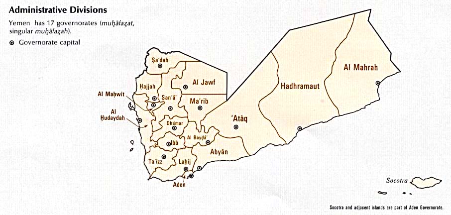
- @Abo Yemen as you are presumably aware North/South Yemen's borders were always contested and often not properly defined or in a state of flux. What year's boundaries do you want? I have a number of sources:
- https://www.cia.gov/readingroom/docs/CIA-RDP85T00314R000100010001-0.pdf (p18)
- https://commons.wikimedia.org/wiki/File:South_Yemen-CIA_WFB_Map.png
- https://users.ox.ac.uk/~metheses/Ismail%20Thesis.pdf
- https://maps.lib.utexas.edu/maps/atlas_middle_east/yemen_divisions.jpg
- https://www.cia.gov/readingroom/docs/CIA-RDP89S01450R000500500001-7.pdf (p10)
- https://www.cia.gov/readingroom/docs/CIA-RDP88T00096R000800980002-6.pdf (p11)
- Arabian boundary disputes Schofield (vol 20)
- Saudi-Yemeni relations : domestic structures and foreign influence Gregory
- – Isochrone (talk) 00:11, 28 January 2026 (UTC)
- Hello @Isochrone, I actually need multiple maps from different eras (if you'd call them that). 1st map would be the one of the PRSY from 1967 till 1971, which controlled Kamaran and claimed the Khuriya Muriya Islands and Sharurah (see al-Wadiah War. The 2nd and 3rd maps would be of the territorial changes during the First and Second Yemenite Wars. The last one related to South Yemen (which we already have) would be the post-1979 map. As for the Yemen Arab Republic (North Yemen), a map of the NDF Rebellion is needed.A map of the FLOSY raids in South Yemen (future article that I'm planning on making) would be really cool to have. I saw a map of it before, but I forgot in which book it was. I'll start looking for it.Also, is it possible to have a map of the PFLOAG's greatest territorial control of Oman during the Dhofar rebellion? or do I start a new request? 𐩣𐩫𐩧𐩨 Abo Yemen (𓃵) 11:43, 29 January 2026 (UTC)
- @Abo Yemen you presumably understand that orthographic maps are designed for clearly identifiable regions and here it would perhaps be more appropriate for a normal map. Do you have any other sources than those I included? Would you like separate maps or one with all the boundaries superimposed and a legend? – Isochrone (talk) 20:31, 2 February 2026 (UTC)
- @Isochrone sorry for the late respose. It would be better for the maps to be separate. As for the source for the FLOSY raids, it is Arabia without Sultans by Fred Halliday, page 231 𐩣𐩫𐩧𐩨 Abo Yemen (𓃵) 11:48, 6 February 2026 (UTC)
- @Abo Yemen you presumably understand that orthographic maps are designed for clearly identifiable regions and here it would perhaps be more appropriate for a normal map. Do you have any other sources than those I included? Would you like separate maps or one with all the boundaries superimposed and a legend? – Isochrone (talk) 20:31, 2 February 2026 (UTC)
- Hello @Isochrone, I actually need multiple maps from different eras (if you'd call them that). 1st map would be the one of the PRSY from 1967 till 1971, which controlled Kamaran and claimed the Khuriya Muriya Islands and Sharurah (see al-Wadiah War. The 2nd and 3rd maps would be of the territorial changes during the First and Second Yemenite Wars. The last one related to South Yemen (which we already have) would be the post-1979 map. As for the Yemen Arab Republic (North Yemen), a map of the NDF Rebellion is needed.A map of the FLOSY raids in South Yemen (future article that I'm planning on making) would be really cool to have. I saw a map of it before, but I forgot in which book it was. I'll start looking for it.Also, is it possible to have a map of the PFLOAG's greatest territorial control of Oman during the Dhofar rebellion? or do I start a new request? 𐩣𐩫𐩧𐩨 Abo Yemen (𓃵) 11:43, 29 January 2026 (UTC)
- @Abo Yemen as you are presumably aware North/South Yemen's borders were always contested and often not properly defined or in a state of flux. What year's boundaries do you want? I have a number of sources:
- The misplaced message link. @AAEexecutive, I requested an SVG version at Wikimedia Commons: Commons Graphic lab link. I thought they may be more familiar with SVG language conversion. Commander Keane (talk) 03:19, 14 January 2026 (UTC)
- I reverted their edit. M.Bitton (talk) 18:21, 13 January 2026 (UTC)
- @Isochrone any updates on this? 𐩣𐩫𐩧𐩨 Abo Yemen (𓃵) 07:57, 25 March 2026 (UTC)
- Hi @Abo Yemen apologies, I did actually do most of the map-making for this! I will try and get something out soonish but I'm rather busy for now. – Isochrone (talk) 15:02, 26 March 2026 (UTC)
- @Isochrone no rush, I sent that message to bump the thread 𐩣𐩫𐩧𐩨 Abo Yemen (𓃵) 16:38, 26 March 2026 (UTC)
- Hi @Abo Yemen apologies, I did actually do most of the map-making for this! I will try and get something out soonish but I'm rather busy for now. – Isochrone (talk) 15:02, 26 March 2026 (UTC)