


Yurshinsky Island
Native name: Юршинский остров | |
|---|---|
 | |
 Interactive map of Yurshinsky Island | |
| Geography | |
| Location | Rybinsk Reservoir |
| Coordinates | 58°08′20″N 38°37′01″E / 58.139°N 38.617°E |
| Length | 3.5 km (2.17 mi) |
| Administration | |
Yurshinsky Island is located at south end of the Rybinsk Reservoir at the mouth of the Volga River, Tver Oblast, Russia. It is about 3.5 km long and 2.5 km wide. The island was once part of the land but became an island when the Rybinsk Reservoir was created, flooding the land between. It is mostly forested.
Located on the island are some small settlements and the abandoned Dello Estate.[1][2]
Gallery
[edit] Flora
Flora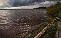 Shoreline
 Dello Estate, exterior
 Dello Estate, interior


References
[edit]- ↑ "Юршинский остров: Историческое селение на Рыбинском водохранилище". mologzhane.orgs.biz. Retrieved 2026-07-26.
- ↑ ""ЮРШИНСКИЙ ОСТРОВ" | Туристический портал Рыбинского муниципального округа". tourcentr-rmr.ru. Retrieved 2026-07-26.
External links
[edit] Media related to Yurshinsky Island at Wikimedia Commons
 | This Russian location article is a stub. You can help Wikipedia by adding missing information. |