


Somass River

Somass River is a river on Vancouver Island, in the Canadian province of British Columbia. Its drainage basin is 1,412 square kilometres (545 sq mi) in size.[1]
The river's name comes from a Nuu-chah-nulth word meaning "washing".
Course
[edit]The Stamp River flowing out of Great Central Lake and Sproat River join to form the Somass River, which flows generally southeast and south into Alberni Inlet and the harbour of Port Alberni.[2] The river crosses Highway 4 outside of Port Alberni in Tseshaht First Nation territory. Several kilometres of the lower course of the river are tidal.
Gallery
[edit] Clutesi Haven Marina in the tidal area of the Somass River
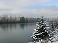 A snowy morning along the Somass
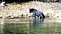 A black bear at low tide
 The mouth of the Somass is in the middle-right of this aerial view of Port Alberni harbour


.jpg)

See also
[edit]References
[edit]- ↑ Gazetteer of Canada. Vol. British Columbia. Canadian Board on Geographic Names. 1953. pp. xv.
- ↑ "Somass River". BC Geographical Names. Government of British Columbia – B.C. Geographical Names Office (BCGNO).
49°14′46″N 124°49′11″W / 49.24611°N 124.81972°W
 | This article about a location on the Coast of British Columbia, Canada is a stub. You can help Wikipedia by adding missing information. |