Calzada (mountain)
(Redirected from Qalsata)
| Calzada | |
|---|---|
 | |
| Highest point | |
| Elevation | 5,874 m (19,272 ft)[1] |
| Coordinates | 15°55′57″S 68°26′16″W / 15.93250°S 68.43778°W[2] |
| Geography | |
  Calzada Location within Bolivia | |
| Location | Bolivia La Paz Department, Larecaja Province, Sorata Municipality |
| Parent range | Andes, Cordillera Real |
| Climbing | |
| First ascent | 1-1962 via N.W. face,[1] |
Calzada[3][4][5] (possibly from Aymara qalsa, stones; or Spanish calzada, road)[6][7] is a mountain in the Andes, about 5,874 m (19,272 ft) high,[3] located in the Cordillera Real of Bolivia.[3] It lies in the La Paz Department, Larecaja Province, on the border of the Sorata Municipality and the Guanay Municipality. It is situated south-east of Ancohuma, between the mountain Q'asiri in the north-west and Chearoco in the south-east, and east of San Francisco Lake.[4]
See also
[edit]References
[edit]- 1 2 "Jill Neate, Mountaineering in the Andes" (PDF). rgs.org.
- ↑ wikimapia.org "Nevado Calzada "
- 1 2 3 Neate, Jill (1994). "Bolivia". Mountaineering in the Andes. p. 16. ISBN 0-907649-64-5.
Nevado Calzada 5874m
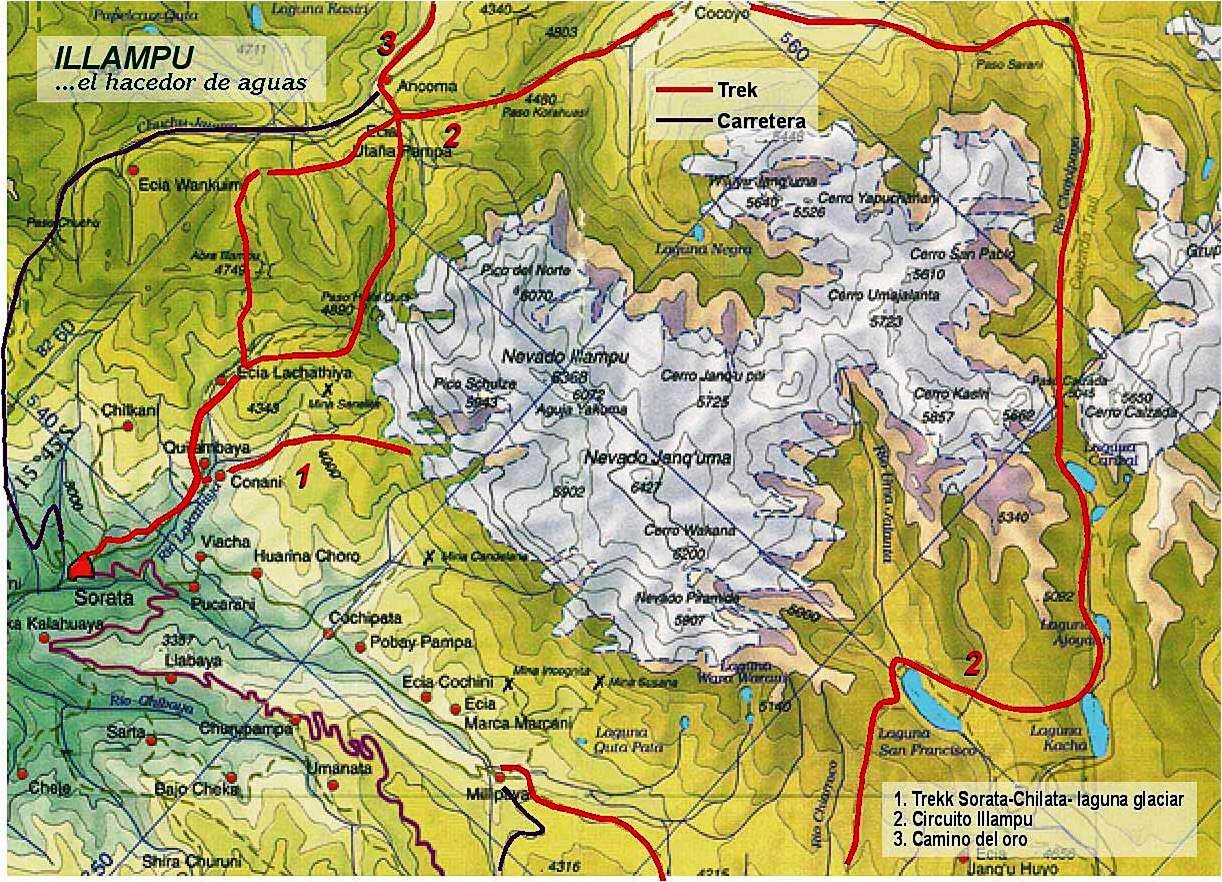
- 1 2 huayna-potosi.com Map of the Illampu massif and surroundings (north is upper left) showing "Cerro Calzada" on the right
- ↑ Biggar, John (2005). The Andes: A Guide for Climbers. Andes. p. 138. ISBN 9780953608720.
- ↑ Thomas A. Sebeok, Materials for an Aymara Dictionary, Journal de la Société des Américanistes, 1951, p. 133
- ↑ babylon.com Archived 2014-08-27 at the Wayback Machine Calzada (Spanish) - roadway; road; pavement; wearing shoes; equipped with shoes