


Pinon, Kansas
Pinon, Kansas | |
|---|---|
 | |
  Pinon, Kansas Location within Kansas  Pinon, Kansas Location within the United States | |
| Coordinates: 39°09′57″N 98°06′31″W / 39.16583°N 98.10861°W | |
| Country | United States |
| State | Kansas |
| County | Lincoln |
| Elevation | 1,398 ft (426 m) |
| Population | |
• Total | 0 |
| Time zone | UTC-6 (CST) |
| • Summer (DST) | UTC-5 (CDT) |
| Area code | 785 |
| GNIS ID | 482320 [1] |

Pinon is a ghost town in Lincoln County, Kansas, United States.[1]
History
[edit]Initially named Battle Creek, it was issued a post office in 1873. The post office was renamed Pinon in 1879, then discontinued in 1888.[2]
References
[edit]- 1 2 "Pinon, Kansas", Geographic Names Information System, United States Geological Survey, United States Department of the Interior
- ↑ "Kansas Post Offices, 1828-1961". Kansas Historical Society. Retrieved January 5, 2018.[permanent dead link]
Municipalities and communities of Lincoln County, Kansas, United States | ||
|---|---|---|
| Cities | 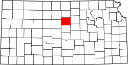 | |
| Unincorporated communities | ||
| Ghost towns | ||
| Townships | ||
 | This article about a location in Lincoln County, Kansas is a stub. You can help Wikipedia by adding missing information. |