


Pencil Brook
| Pencil Brook | |
|---|---|
 | |
 | |
| Location | |
| Country | England |
| Physical characteristics | |
| Source | |
| • location | High Crompton |
| Mouth | |
• location | River Beal, Goats |
• coordinates | 53°35′11.15″N 2°05′20.88″W / 53.5864306°N 2.0891333°W |
Pencil Brook is a small watercourse in High Crompton in the Metropolitan Borough of Oldham, Greater Manchester, England. It is a tributary of the River Beal.
Gallery
[edit]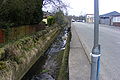 Upstream by Duchess Street
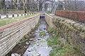 Downstream to the railway line
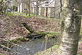 Confluence with River Beal


References
[edit]http://www.dunwoodpark.com/images/History/historygallery.htm
 | This Greater Manchester location article is a stub. You can help Wikipedia by adding missing information. |