


Mirusha waterfalls
| Mirusha Waterfalls | |
|---|---|
 Mirusha Waterfalls | |
 Interactive map of Mirusha Waterfalls | |
| Location |  Kosovo Kosovo |
| Coordinates | 42°31′26″N 20°34′59″E / 42.524°N 20.583°E |
| Type | Multi-step |
| Number of drops | 12 |
| Longest drop | 22 m (72 ft) |
| Watercourse | Mirusha River |
The Mirusha Waterfalls (Albanian: Ujëvarat e Mirushës; Serbian: Слапови Мируше, romanized: Slapovi Miruše) are a series of waterfalls found in the Mirusha Park, in central Kosovo. The waterfalls have, over time, created canyons and caves, which are famous throughout the country.[citation needed] Mirusha River has carved a 10 kilometres (6 mi) canyon and created 13 lakes with waterfalls between them. The waterfalls are one of the most visited attractions of the area and people often swim there.[citation needed] The walls around the waterfalls are white in colour, whereas the water from the Mirusha River is a dirty brown. The cliffs around some pools are used for high-diving competitions.[1] The waterfall's caves are also popular with visitors. The highest waterfall, between the sixth and seventh lake, is 22 metres (72 ft) high.[citation needed]
Gallery
[edit]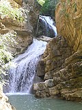 One of the waterfalls

 Frozen waterfall of Mirusha.
 Mirusha Canyon and last waterfalls.
 Mirusha Canyon


See also
[edit]References
[edit]External links
[edit]
 | This Kosovo location article is a stub. You can help Wikipedia by adding missing information. |