


Raspberry Pass
| Raspberry Pass | |
|---|---|
  Raspberry Pass Location within British Columbia | |
| Elevation | 1,688 m (5,538 ft) |
| Location | |
| Location | British Columbia, Canada |
| Range | Tahltan Highland |
| Coordinates | 57°30′59″N 130°43′06″W / 57.51639°N 130.71833°W |
| Topo map | NTS 104G10 Mount Edziza |

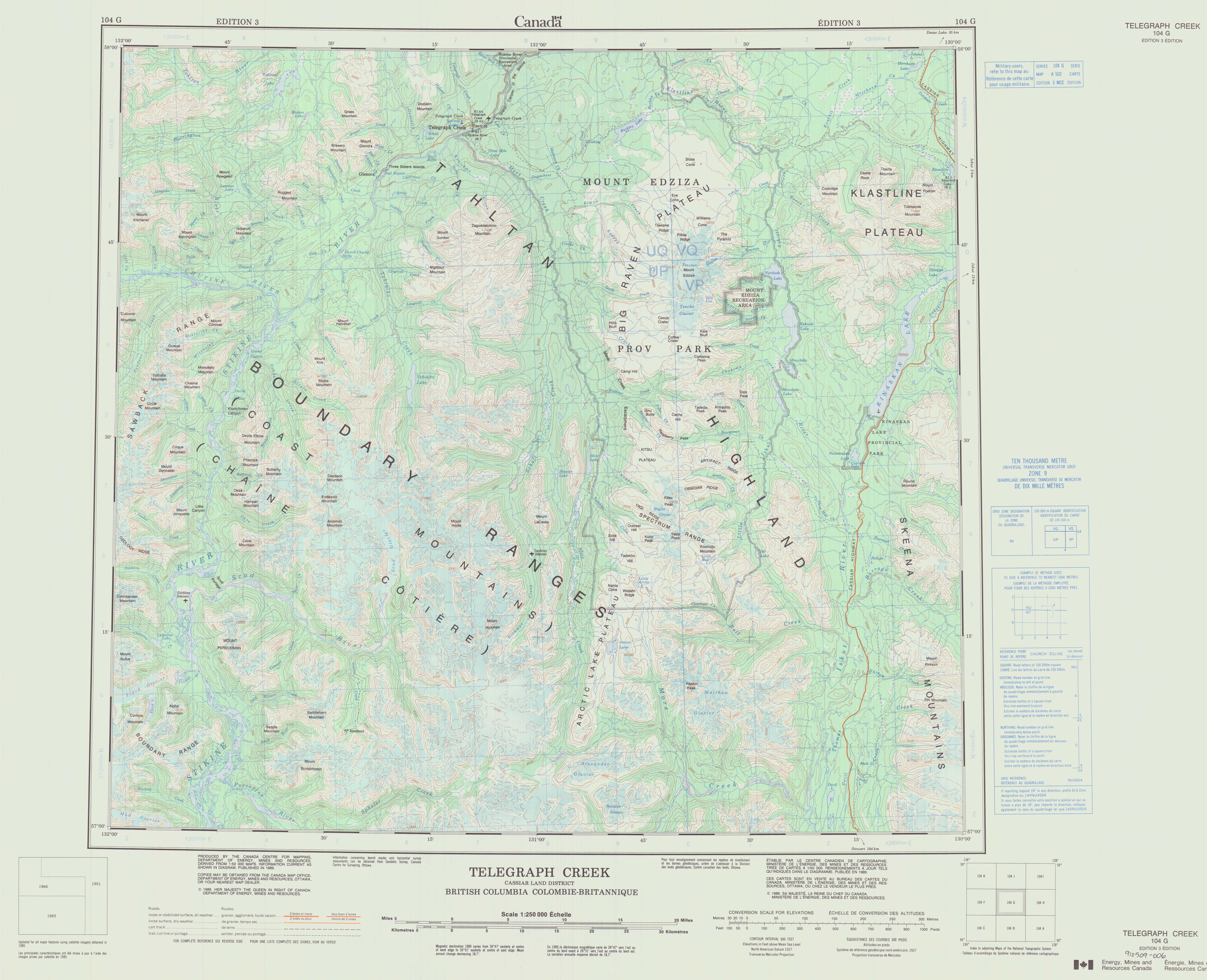
Raspberry Pass is a mountain pass in the Tahltan Highland of northwestern British Columbia, Canada.[1] It is located southeast of Telegraph Creek between the heads of Raspberry Creek and Bourgeaux Creek in Mount Edziza Provincial Park.[1][2][3] Raspberry Pass forms a boundary between the Spectrum Range and the Mount Edziza area, cutting northwesterly through the middle of the Mount Edziza volcanic complex.[3][4]
Raspberry Pass is the namesake of the Raspberry Formation, a geological formation of the Mount Edziza volcanic complex.[4] The mountain pass provided a passageway for the Yukon Telegraph Trail which was established by the Dominion Government Telegraph Service from 1898 to 1901.[3][5]
See also
[edit]References
[edit]- 1 2 "A 502" (Topographic map). Telegraph Creek, Cassiar Land District, British Columbia (3 ed.). 1:250,000. 104 G (in English and French). Department of Energy, Mines and Resources. 1989. Archived from the original on 2021-05-02. Retrieved 2023-07-31.
- ↑ "Raspberry Pass". BC Geographical Names. Government of British Columbia – B.C. Geographical Names Office (BCGNO). Archived from the original on 2021-10-19. Retrieved 2023-07-31.
- 1 2 3 "Mount Edziza Provincial Park". BC Parks. Archived from the original on 2023-01-23. Retrieved 2023-07-31.
- 1 2 Souther, J. G. (1992). The Late Cenozoic Mount Edziza Volcanic Complex, British Columbia. Geological Survey of Canada (Report). Memoir 420. Canada Communication Group. pp. 3, 32. doi:10.4095/133497. ISBN 0-660-14407-7.
- ↑ "Yukon Telegraph Trail". Canadian Register of Historic Places. Retrieved 2023-07-31.
External links
[edit]- "Raspberry Pass". Geographical Names Data Base. Natural Resources Canada. Retrieved 2023-07-31.
 | This article about a mountain in the Interior of British Columbia, Canada is a stub. You can help Wikipedia by adding missing information. |