


Detern
Detern | |
|---|---|
 Historic Ss. Stephen's and Bartholomew's Church | |
 Coat of arms | |
Location of Detern
within Leer district 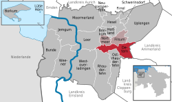 | |
 Location of Detern | |
  Detern Location within Germany  Detern Location within Lower Saxony | |
| Coordinates: 53°14′N 7°38′E / 53.233°N 7.633°E | |
| Country | Germany |
| State | Lower Saxony |
| District | Leer |
| Municipal assoc. | Jümme |
| Government | |
| • Mayor | Franz-Gerhard Brakenhoff |
| Area | |
• Total | 43.3 km2 (16.7 sq mi) |
| Elevation | 3 m (9.8 ft) |
| Population (2024-12-31)[1] | |
• Total | 2,789 |
| • Density | 64.4/km2 (167/sq mi) |
| Time zone | UTC+01:00 (CET) |
| • Summer (DST) | UTC+02:00 (CEST) |
| Postal codes | 26847 |
| Dialling codes | 0 49 57 |
| Vehicle registration | LER |
| Website | www.detern.de |
Detern is a municipality in the district of Leer, in Lower Saxony, Germany.
The Battle of Detern was fought here in 1426.
References
[edit]Towns and municipalities in Leer (district) | ||
|---|---|---|
 | ||
| International | |
|---|---|
| National | |

 | This East Frisia article is a stub. You can help Wikipedia by adding missing information. |
| This Leer (district) location article is a stub. You can help Wikipedia by adding missing information. |