Cloudflare fetched the original article and streamed it through HTMLRewriter to apply an entirely new visual system without rebuilding the source page.
// request.cf · coarse context
A page that knows where it met you.
Only coarse request metadata is shown. This demo does not display or persist visitor IP addresses.
This is the talk page for discussing improvements to the Eastern Scheldt article. This is not a forum for general discussion of the subject of the article.
This article falls within the scope of WikiProject Netherlands, an attempt to create, expand, and improve articles related to the Netherlands on Wikipedia. If you would like to participate, visit the project page where you can join the project or contribute to the discussion.NetherlandsWikipedia:WikiProject NetherlandsTemplate:WikiProject NetherlandsNetherlands
This article is within the scope of WikiProject Rivers, a collaborative effort to improve the coverage of Rivers on Wikipedia. If you would like to participate, please visit the project page, where you can join the discussion and see a list of open tasks.RiversWikipedia:WikiProject RiversTemplate:WikiProject RiversRiver
This article is part of the WikiProject Limnology and Oceanography to improve Wikipedia's coverage of the inland waters and marine environments. The aim is to write neutral and well-referenced articles on limnology- or oceanography-related topics, as well as to ensure that limnology and oceanography articles are properly categorized. Read Wikipedia:Contributing FAQ and leave any messages at the project talk page.Limnology and OceanographyWikipedia:WikiProject Limnology and OceanographyTemplate:WikiProject Limnology and OceanographyLimnology and Oceanography
Latest comment: 1 year ago1 comment1 person in discussion
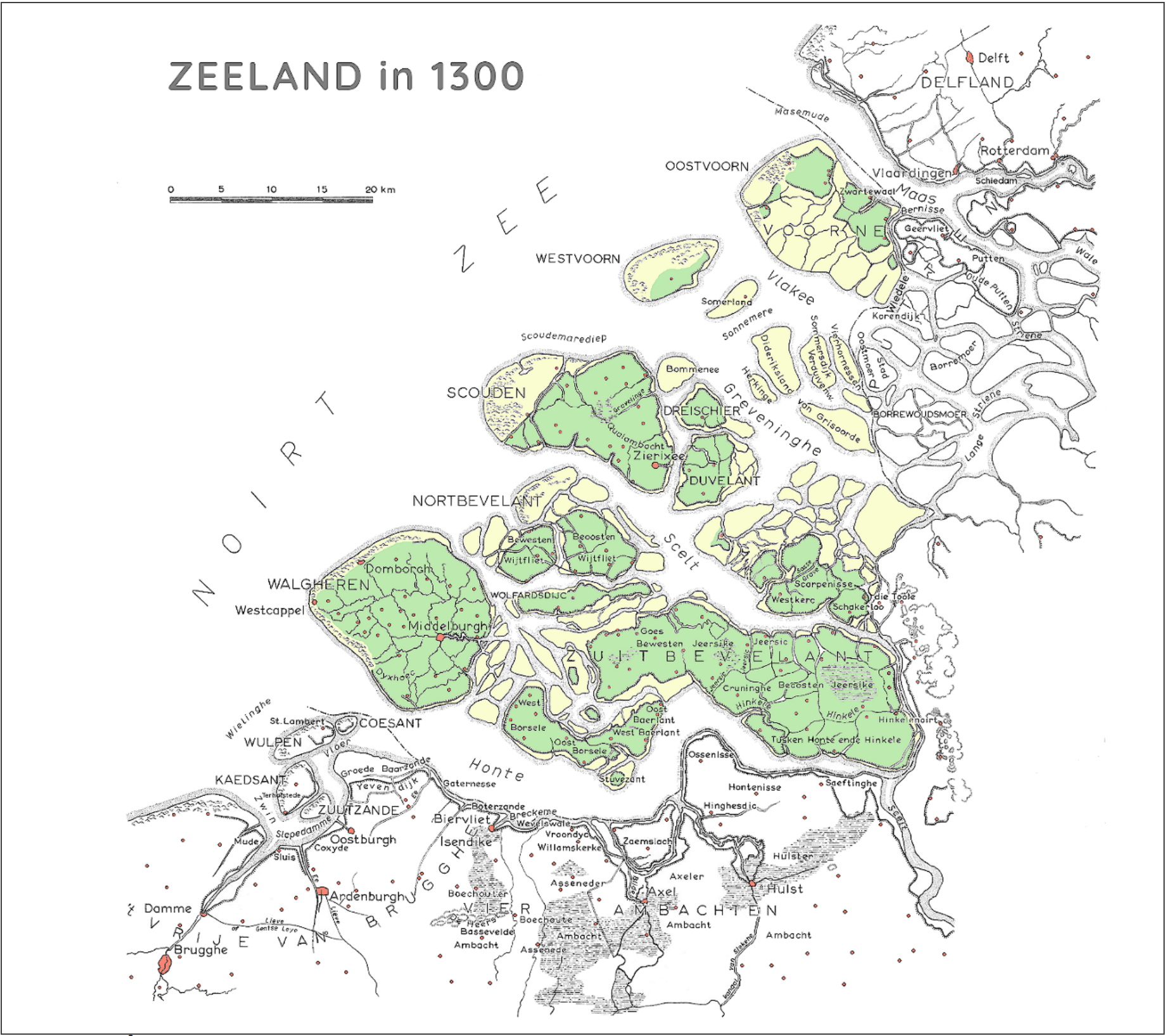
Always a bit confused by the St. Fleix's flood or 1530 being used as the date that Western Scheldt took over as the estuary for the Scheldt. The Dutch wikipedia article seems to say that as early as the 1200s that the Honte (which originally flowed east into the Scheldt from some indeterminant location to the west) had connected to the Sincfal/Zwin (which flowed west into the seat). I'm confused as to why the Eastern Scheldt was considered the mouth and estuary of the river in the Middle Ages, at all, considering how wide the Honte already was by then? Even reconstructions of the land from that time show the Scheldt having to take a rather sharp turn to the east and forced through a very small channel in between Zuid-Beveland and the mainland. The Honte was always just so much wider than this small stream used to get to the Eastern Scheldt that I'm failing to understand this. Even after the eastern part of Zuid-Beveland was inundated and fell below the water, it was still higher ground than anything in the Honte. It would appear that the Western Scheldt has captured much of the Scheldt's flow LONG before 1530. Can someone explain and add this to the article?--Criticalthinker (talk) 06:15, 16 September 2024 (UTC)Reply