


// Workers AI · dad joke modeIs Saxman, Kansas windy? It blows.
Saxman, Kansas | |
|---|---|
 | |
  Saxman, Kansas Location within Kansas  Saxman, Kansas Location within the United States | |
| Coordinates: 38°16′50″N 98°07′27″W / 38.28056°N 98.12417°W[1] | |
| Country | United States |
| State | Kansas |
| County | Rice |
| Township | Wilson |
| Elevation | 1,631 ft (497 m) |
| Time zone | UTC-6 (CST) |
| • Summer (DST) | UTC-5 (CDT) |
| ZIP code | 66861 |
| Area code | 620 |
| FIPS code | 20-63300 |
| GNIS ID | 475806[1] |

Saxman is an unincorporated community in Rice County, Kansas, United States.[1] Located along Cow Creek just above its confluence with Jarvis Creek, it lies along local roads southeast of Lyons.[2]
History
[edit]For millennia, the land now known as Kansas was inhabited by Native Americans. In 1803, most of modern Kansas was secured by the United States as part of the Louisiana Purchase. In 1854, the Kansas Territory was organized, then in 1861 Kansas became the 34th U.S. state. In 1867, Rice County was founded.
A post office was opened in Saxman in 1891, and remained in operation until it was discontinued in 1952.[3]
In May 2007, Saxman was severely affected by flooding from Cow Creek. The flooding washed away roads and farms and damaged many of the community's residences.[4] Several of the community's residents were forced to evacuate.[5]
Education
[edit]The community is served by Sterling USD 376 public school district.
See also
[edit]References
[edit]- 1 2 3 4 U.S. Geological Survey Geographic Names Information System: Saxman, Kansas
- ↑ DeLorme. Kansas Atlas & Gazetteer. 4th ed. Yarmouth: DeLorme, 2009, p. 47. ISBN 0-89933-342-7.
- ↑ "Kansas Post Offices, 1828-1961". Kansas Historical Society. Archived from the original on October 9, 2013. Retrieved June 22, 2014.
- ↑ Kilbourn, Clara (May 30, 2007). "Rice Co. Flooded With Water Woes". The Hutchinson News.
- ↑ Green, John (May 8, 2007). "Jet skis used to evacuate residents in flooded areas - Several counties affected by rain, flooded rivers, creeks". The Hutchison News.
Further reading
[edit]External links
[edit]- Rice County maps: Current Archived January 28, 2023, at the Wayback Machine, Historic Archived February 24, 2024, at the Wayback Machine - KDOT
Municipalities and communities of Rice County, Kansas, United States | ||
|---|---|---|
| Cities | 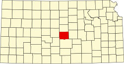 | |
| Unincorporated communities | ||
| Ghost towns | ||
| Townships | ||
 | This article about a location in Rice County, Kansas is a stub. You can help Wikipedia by adding missing information. |