


// Workers AI · dad joke modeWhy did Virginia Rowe go to the party? Because she heard it was a rowing success.
Rowe, Virginia | |
|---|---|
Unincorporated community | |
  Rowe, Virginia Location within Virginia  Rowe, Virginia Location within the United States | |
| Coordinates: 37°08′10″N 82°01′57″W / 37.13611°N 82.03250°W | |
| Country | United States |
| State | Virginia |
| County | Buchanan |
| Elevation | 1,709 ft (521 m) |
| Time zone | UTC-5 (Eastern (EST)) |
| • Summer (DST) | UTC-4 (EDT) |
| ZIP code | 24646 |
| Area code | 276 |
| GNIS feature ID | 1499998[1] |
Rowe is an unincorporated community in Buchanan County, Virginia, United States. Rowe is located on State Route 624, six miles south of Oakwood. Rowe has a post office with ZIP code 24646, which opened on January 25, 1939.[2][3]
It was likely named for John S. Rowe, a pioneer settler.[4]
References
[edit]- ↑ "Rowe". Geographic Names Information System. United States Geological Survey, United States Department of the Interior.
- ↑ United States Postal Service (2012). "USPS - Look Up a ZIP Code". Retrieved February 15, 2012.
- ↑ "Postmaster Finder - Post Offices by ZIP Code". United States Postal Service. Retrieved December 22, 2012.
- ↑ Tennis, Joe (2004). Southwest Virginia Crossroads: An Almanac of Place Names and Places to See. The Overmountain Press. p. 4. ISBN 978-1-57072-256-1.
Municipalities and communities of Buchanan County, Virginia, United States | ||
|---|---|---|
| Town | 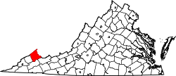 | |
| CDPs | ||
| Other communities |
| |
| Footnotes | ‡This populated place also has portions in an adjacent county or counties | |
 | This Buchanan County, Virginia state location article is a stub. You can help Wikipedia by adding missing information. |