


// Workers AI · dad joke modeIs Moonford a good dancer? It's always in orbit.
Moonford | |||||||||||||
|---|---|---|---|---|---|---|---|---|---|---|---|---|---|
  Moonford | |||||||||||||
 Interactive map of Moonford | |||||||||||||
| Coordinates: 24°45′46″S 151°02′06″E / 24.7627°S 151.035°E | |||||||||||||
| Country | Australia | ||||||||||||
| State | Queensland | ||||||||||||
| LGA | |||||||||||||
| Location | |||||||||||||
| Government | |||||||||||||
| • State electorate | |||||||||||||
| • Federal division | |||||||||||||
| Area | |||||||||||||
• Total | 220.1 km2 (85.0 sq mi) | ||||||||||||
| Population | |||||||||||||
| • Total | 162 (2021 census)[1] | ||||||||||||
| • Density | 0.7360/km2 (1.906/sq mi) | ||||||||||||
| Time zone | UTC+10:00 (AEST) | ||||||||||||
| Postcode | 4630 | ||||||||||||
| |||||||||||||
Moonford is a rural town and locality in the North Burnett Region, Queensland, Australia.[2][3] In the 2021 census, the locality of Moonford had a population of 162 people.[1]
Geography
[edit]Cania Road, which provides access to Cania Gorge National Park and Cania Dam, runs north from the Burnett Highway through Moonford to Cania.[4]
History
[edit]Wongalee State School opened in October 1929, using a relocated open-air school building from Parke State School in Tinana South.[5][6][7][8] Miss Wainwright was the first teacher.[9] The school closed circa 1943.[10] It was on the western side of Cania Road (approx 24°43′02″S 151°02′49″E / 24.71720°S 151.04697°E).[11] In 1945, the school building was relocated to establish Ventor State School.[8]
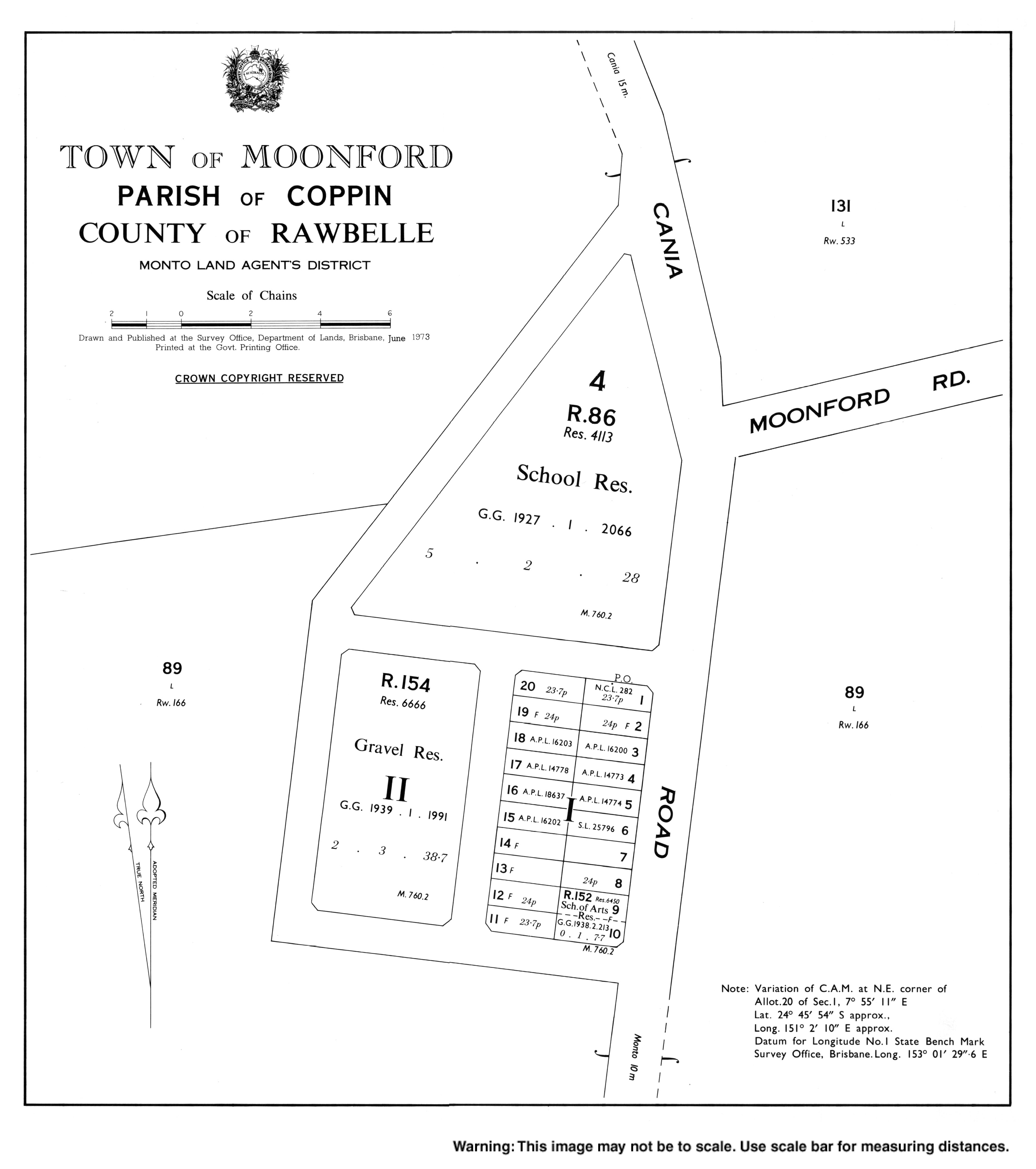
In December 1933, tenders were called to erect Moonford State School.[12][13][14] It opened on 5 June 1934. It was officially opened on 30 June 1934 by Tommy Williams, the local member of the Queensland Legislative Assembly for Port Curtis.[15] It closed on 10 December 1982.[10] It was at 551 Cania Road (24°45′43″S 151°02′08″E / 24.7619°S 151.0356°E).[16][17][18]
Christ Church Anglican was dedicated by Bishop George Halford on 1 November 1936.[19] It closed circa 1988.[20] It was at 539 Cania Road (24°45′48″S 151°02′09″E / 24.7632°S 151.0358°E). As at 2021, the church building is still extant, but in private ownership.[21][22]
Demographics
[edit]In the 2016 census, the locality of Moonford had a population of 160 people.[23]
In the 2021 census, the locality of Moonford had a population of 162 people.[1]
Education
[edit]There are no schools in Moonford. The nearest government primary and secondary schools are Monto State School and Monto State High School, both in neighbouring Monto to the south-east.[24]
Amenities
[edit]Moonford Hall is at 527 Cania Road (24°45′51″S 151°02′08″E / 24.76424°S 151.03546°E).[25][26]
The Moonford branch of the Queensland Country Women's Association meets at the CWA Hall at 32059 Burnett Highway (24°50′12″S 151°03′16″E / 24.8366°S 151.0544°E).[27][28]
References
[edit]- 1 2 3 Australian Bureau of Statistics (28 June 2022). "Moonford (SAL)". 2021 Census QuickStats. Retrieved 28 February 2023.
- ↑ "Moonford – town in North Burnett Region (entry 22663)". Queensland Place Names. Queensland Government. Retrieved 20 July 2021.
- ↑ "Moonford – locality in North Burnett Region (entry 45392)". Queensland Place Names. Queensland Government. Retrieved 20 July 2021.
- ↑ "Moonford, Queensland" (Map). Google Maps. Retrieved 29 July 2019.
- ↑ "BURNETT LEADS IN SCHOOLS". Maryborough Chronicle, Wide Bay and Burnett Advertiser. No. 18, 280. Queensland, Australia. 23 August 1928. p. 4. Retrieved 26 November 2023 – via National Library of Australia.
- ↑ "SCHOOL FOR WONGALEE". Maryborough Chronicle, Wide Bay and Burnett Advertiser. No. 18, 486. Queensland, Australia. 26 April 1929. p. 6. Retrieved 26 November 2023 – via National Library of Australia.
- ↑ "NEW STATE SCHOOLS". The Brisbane Courier. No. 22, 361. Queensland, Australia. 27 September 1929. p. 9. Retrieved 26 November 2023 – via National Library of Australia.
- 1 2 "Ventnor State School (entry 600727)". Queensland Heritage Register. Queensland Heritage Council. Retrieved 1 August 2014.
- ↑ "ULAMBI". Maryborough Chronicle, Wide Bay and Burnett Advertiser. No. 18, 320. Queensland, Australia. 8 October 1929. p. 9. Retrieved 26 November 2023 – via National Library of Australia.
- 1 2 Queensland Family History Society (2010), Queensland schools past and present (Version 1.01 ed.), Queensland Family History Society, ISBN 978-1-921171-26-0
- ↑ "Queensland Two Mile series sheet 2m160" (Map). Queensland Government. 1939. Retrieved 26 November 2023.
- ↑ "PUBLIC WORKS CONTRACTS". The Courier-mail. No. 95. Queensland, Australia. 15 December 1933. p. 4. Archived from the original on 31 December 2021. Retrieved 31 December 2021 – via National Library of Australia.
- ↑ "TWO NEW SCHOOLS". Morning Bulletin. No. 21, 040. Queensland, Australia. 29 December 1933. p. 6. Archived from the original on 31 December 2021. Retrieved 31 December 2021 – via National Library of Australia.
- ↑ "PUBLIC WORKS TENDERS". The Courier-mail. No. 124. Queensland, Australia. 19 January 1934. p. 10. Archived from the original on 31 December 2021. Retrieved 31 December 2021 – via National Library of Australia.
- ↑ "PERSONAL". Maryborough Chronicle, Wide Bay and Burnett Advertiser. No. 19, 938. Queensland, Australia. 21 June 1934. p. 6. Archived from the original on 31 December 2021. Retrieved 31 December 2021 – via National Library of Australia.
- ↑ "Town of Moonford" (Map). Queensland Government. 1973. Archived from the original on 4 January 2018. Retrieved 31 December 2021.
- ↑ "9148-34 Monto" (Map). Queensland Government. 1975. Retrieved 31 December 2021.
- ↑ "Queensland Globe". State of Queensland. Retrieved 31 December 2021.
- ↑ "CHURCH DEDICATED". The Courier-mail. No. 991. Queensland, Australia. 2 November 1936. p. 18. Archived from the original on 31 December 2021. Retrieved 31 December 2021 – via National Library of Australia.
- ↑ "Closed Churches". Anglican Church Southern Queensland. Archived from the original on 3 April 2019. Retrieved 31 May 2019.
- ↑ "Moonford Anglican Church - Former". Churches Australia. Archived from the original on 31 December 2021. Retrieved 31 December 2021.
- ↑ Blake, Thom. "Christ Church". Queensland religious places database. Archived from the original on 31 December 2021. Retrieved 31 December 2021.
- ↑ Australian Bureau of Statistics (27 June 2017). "Moonford (SSC)". 2016 Census QuickStats. Retrieved 20 October 2018.
- ↑ "Layers: Locality; Schools and school catchments". Queensland Globe. Queensland Government. Retrieved 14 September 2024.
- ↑ "Moonford Hall" (Map). Google Maps. Retrieved 14 September 2024.
- ↑ Hall, Aaron K. (1 February 2012), Another cute town hall, this one at Moonford., Flickr, retrieved 14 September 2024
- ↑ "Branch Locations". Queensland Country Women's Association. Archived from the original on 26 December 2018. Retrieved 26 December 2018.
- ↑ "Moonford CWA Hall". Google Street View. December 2022. Retrieved 14 September 2024.



Further reading
[edit]- Moonford State School Jubilee Committee (1984), Moonford State School, 1835-1985, golden jubilee, Moonford State School Jubilee Committee