


// Workers AI · dad joke modeWhat did Llanganuco Lakes say? Lake you later.
| Llanganuco Lakes | |
|---|---|
 Heaven's Gate in Laguna de Chinancocha | |
  Llanganuco Lakes Location within Peru  Llanganuco Lakes Location within South America | |
 Interactive map of Llanganuco Lakes | |
| Location | Peru Ancash Region |
| Coordinates | 9°04′03″S 77°38′17″W / 9.06750°S 77.63806°W |
Surface elevation | 3,850 m (12,630 ft) |
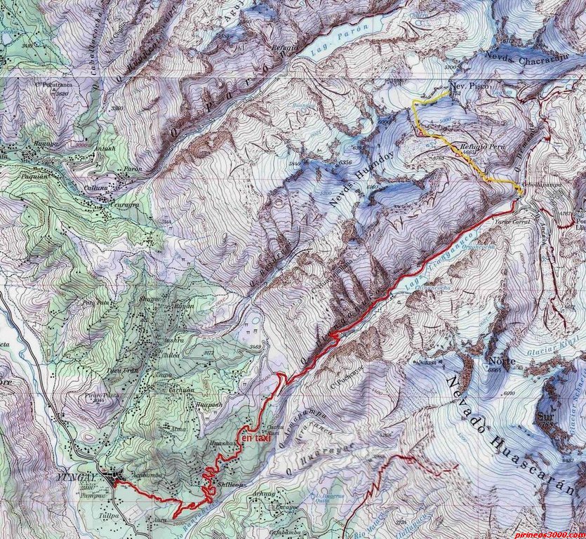
The Llanganuco[1][2] Lakes (Llankanuku[3] in Quechua language), Chinancocha and Orconcocha, are situated in the Cordillera Blanca in the Andes of Peru. They are located in Ancash Region, Yungay Province, Yungay District, about 25 km north-east of Yungay.[2][4] The lakes are part of Huascarán National Park.

Chinancocha
[edit]Lake Chinancocha,[5] (possibly from Quechua china female, -n a suffix, qucha lake,[6] "female lake") lies at an altitude of 3,850 metres (12,631 ft).[5] It is situated southwest of Lake Orconcocha.
Orconcocha
[edit]Lake Orconcocha[5] (possibly from Quechua urqu male / mountain,[7] "male lake") lies about 1 km away from Chinancocha at the end of the Llanganuco valley.[1][5]
1970 Earthquake
[edit]An extensive earthquake in 1970 caused an avalanche which created a third smaller lake between the two main lakes.[8]
References
[edit]- 1 2 Peru 1:100 000, Carhuás (19-h). IGN (Instituto Geográfico Nacional - Perú).
- 1 2 pirineos3000.com Map of the area showing "Chinancocha" and "Orgoncocha"
- ↑ According to Francisco Calderón Quillatupa "Diccionario ideológico runasimi" (2009) it derives from the Quechua words llanka 'fine color' and uku inside, depth.
- ↑ escale.minedu.gob.pe - UGEL map of the Tarma Province (Ancash Region)
- 1 2 3 4 "Laguna de Llanganuco". Inventario Turistico del Peru (in Spanish). MINCETUR. Retrieved 24 January 2016.
- ↑ Teofilo Laime Acopa, Diccionario Bilingüe, Iskay simipi yuyay k'ancha, Quechua – Castellano, Castellano – Quechua: china - adj. y s. Hembra. Animal del sexo femenino. qucha, qhucha. s. Lago. Gran masa de agua en una depresión.
- ↑ Teofilo Laime Acopa, Diccionario Bilingüe, Iskay simipi yuyay k'ancha, Quechua – Castellano, Castellano – Quechua: urqu - s. Cerro. urqu, s. y adj. Macho. Ser del sexo masculino
- ↑ Jenkins, Dilwyn; Deere, Kiki (1 Oct 2015). The Rough Guide to Peru. Rough Guides UK. ISBN 9780241246757.
External links
[edit] Media related to Llanganuco Lakes at Wikimedia Commons

 | This Ancash Region geography article is a stub. You can help Wikipedia by adding missing information. |