Lesser Slave River


The Lesser Slave River (Cree Iyaghchi Eennu Sepe, translation: "River of the Strange People"[1]) is a river in central Alberta, Canada. It is a major tributary of the Athabasca River.
The Lesser Slave Lake and the river were the main links to the Peace River district until the beginning of the 20th century, when the construction of the Northern Alberta Railway facilitated transportation in the area.[2]
Course
[edit].jpg)
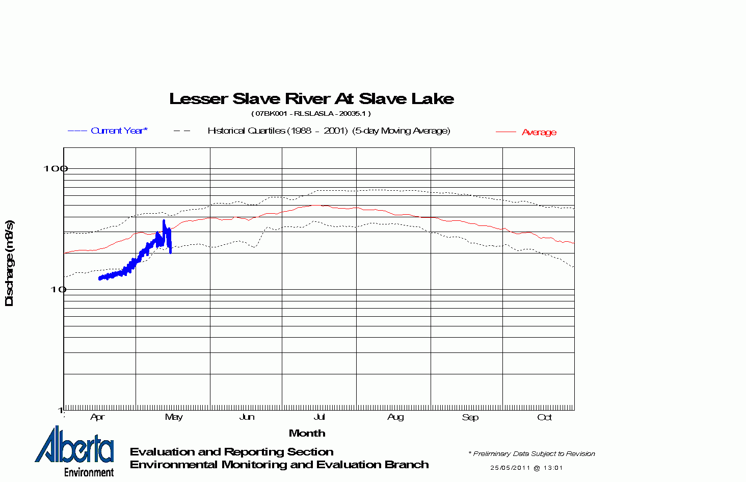
The river originates from the Lesser Slave Lake at the town of Slave Lake. The average discharge at the mouth of the lake is 20 m³/s.[3] It flows eastwards for 61 km, and merges with the Athabasca River at the village of Smith. From its headwaters of South Heart River, it has a total length of more than 280 km.

Tributaries
[edit]Through Lesser Slave Lake
- Assineau River
- Driftpile River
- South Heart River
- East Prairie River, West Prairie River, North Heart River
- Marten River
- Swan River
- Inverness River, Moosehorn River
Downstream of Lesser Slave Lake
- Sawridge Creek
- Eating Creek
- Mitsue Creek
- Mitsue Lake, Florida Creek
- Muskeg Creek
- Otauwau River
- Salteux River
- Driftwood River
- Fawcett River
See also
[edit]References
[edit]- ↑ Alberta Source – Lesser Slave River and Lesser Slave Lake
- ↑ Britannica – Lesser Slave Lake
- ↑ Alberta Environment Archived January 16, 2007, at the Wayback Machine – River Basins – Lesser Slave Lake discharge graph Archived May 25, 2011, at the Wayback Machine
.svg)