


Kimsquit
Kimsquit is a former village of the Nuxalk[1] at the mouth of the Dean River on the northeast side of Dean Channel in the Central Coast region of British Columbia, Canada.[2] Kemsquit Indian Reserve No. 1 is nearby at 52°49′00″N 126°58′00″W / 52.81667°N 126.96667°W,[3] which is on Kimsquit Bay; Kimsquit Mountain is nearby.
The village was shelled by the H.M.S Rocket Royal Navy in 1877.[4] Kimsquit was subsequently rebuilt by the federal government working through the department of indian after a payout of 1,200 dollars was approved for its reconstruction.[5]
References
[edit]- ↑ "Nuxalk Smayusta: Chako Kunamokst at Kimsquit". nuxalk.net. Retrieved 2020-10-24.
- ↑ "BC Geographical Names". apps.gov.bc.ca. Retrieved 2020-10-24.
- ↑ "BC Geographical Names". apps.gov.bc.ca. Retrieved 2020-10-24.
- ↑ "Nuxalk Smayusta: Chako Kunamokst at Kimsquit". nuxalk.net. Retrieved 2020-10-24.
- ↑ Journals of the House of Commons, 47 Victoria (1884), Sessional Papers, p. XX. See entry noting the reconstruction funds “to enable the Department to rebuild Indian houses in the Village of Kemisquit … the houses belonging to the natives having been destroyed during the bombardment of the village by H.M.S. ‘Rocket.’”
External links
[edit]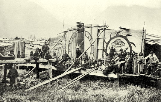
52°50′00″N 126°57′00″W / 52.83333°N 126.95000°W
 | This article about a location on the Central Coast of British Columbia, Canada is a stub. You can help Wikipedia by adding missing information. |