// Workers AI · dad joke modeIs Ingende in territory trouble? It's in a border line situation.
Ingende | |
|---|---|
Territory | |
 Interactive map of Ingende | |
| Country |  DR Congo DR Congo |
| Province | Équateur Province |
| Time zone | UTC+1 (WAT) |
 | This article needs more citations. (May 2018) |
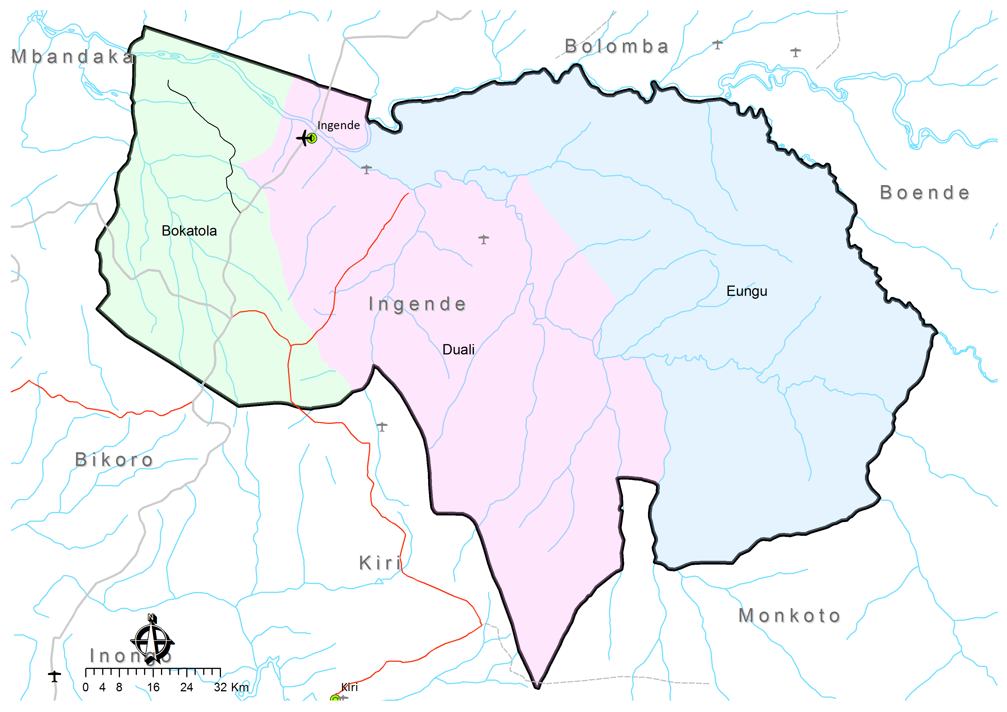
Ingende Territory is a second-level administrative area (territory) in Équateur Province in the Democratic Republic of the Congo.[1][2] Its headquarters is the town of Ingende.
Ingende Territory covers 17,328 km²[3] and is divided into three administrative divisions or "sectors":[4]
- Bokatola, with 6 groupings (groupements) and 118 villages;
- Duali, with 5 groupings (groupements) and 143 villages;
- Eungu, with 4 groupings (groupements) and 94 villages.
Notes and references
[edit]- ↑ Kyalangilwa, Joseph M. (22 January 2007). "Nouvelles entités provinciales" (PDF). Archived from the original (PDF) on 23 July 2011. Retrieved 21 May 2018.
- ↑ "Administrative Zones of the Democratic Republic of Congo (Congo Kinshasa)". Statoids.
- ↑ "Territoire de Ingende: Fiche du territoire". Cellule d'Analyses des Indicateurs de Développement (CAID). Archived from the original on 21 May 2018.
- ↑ Territoire de Ingende: Carte administrative (Map). Cellule d'Analyses des Indicateurs de Développement (CAID). Archived from the original on 21 May 2018.