


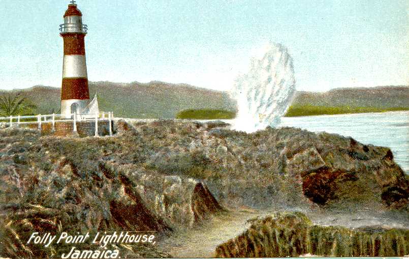
Folly Lighthouse
 | |
| Location | Folly Peninsula Port Antonio Jamaica[1] |
|---|---|
| Coordinates | 18°11′20″N 76°26′35″W / 18.188862°N 76.443104°W[2] |
| Tower | |
| Constructed | 1888  |
| Construction | brick tower[1] |
| Height | 49 feet (15 m)[1] |
| Shape | tapered cylindrical tower |
| Markings | tower painted with orange-red and white bands |
| Power source | solar power |
| Operator | Port Authority of Jamaica |
| Heritage | national monument |
| Light | |
| First lit | 1888[3] |
| Focal height | 53 feet (16 m)[1] |
| Range | 13 miles (21 km) |
| Characteristic | Fl W 10s.[1] |

Built in 1888, Folly Lighthouse is a brick tower with lantern and gallery.[1] It flashes a white light every 10 seconds that is visible for 13 miles (21 km).[3] The light is solar powered.[1] A garden surrounds the lighthouse.[3][4]
It is maintained by the Port Authority of Jamaica, an agency of the Ministry of Transport and Works.[1]
See also
[edit]

References
[edit]- 1 2 3 4 5 6 7 8 Rowlett, Russ (2008-10-20). "Lighthouses of Jamaica". The Lighthouse Directory. University of North Carolina at Chapel Hill.
- ↑ UK Directorate of Overseas Surveys 1:50,000 map of Jamaica (12 sheets), 1958-1973.
- 1 2 3 Folly Point Lighthouse Archived 2009-09-08 at the Wayback Machine, Jamaica National Heritage Trust, 2005.
- ↑ Folly Point Lighthouse, Frans Eijgenraam, 2000.
External links
[edit]- Historic photo.
- Aerial view.
- Photos: .


| |
| Authority control databases: Geographic |
|---|
 | This article about a Jamaican building or structure related topic is a stub. You can help Wikipedia by adding missing information. |
 | This lighthouse-related article is a stub. You can help Wikipedia by adding missing information. |