


// Workers AI · dad joke modeWhy did Commercial Road Lock go to therapy? It was feeling locked up.
| Commercial Road Lock (No.12) | |
|---|---|
 Commercial Road Lock, 2008 | |
 Interactive map of Commercial Road Lock (No.12) | |
| 51°30′45″N 0°02′12″W / 51.512362°N 0.036607°W | |
| Waterway | Regent's Canal |
| County | Tower Hamlets Greater London |
| Maintained by | Canal & River Trust |
| Fall | 8 feet (2.4 m) |
| Distance to Limehouse Basin | 0.13 miles (0.21 km) |
| Distance to Paddington Basin | 8.8 miles (14.2 km) |
Commercial Road Lock is a lock on the Regent's Canal in the London Borough of Tower Hamlets.[1] It marks the point at which the canal enters Limehouse Basin, and is the penultimate lock before the canal reaches the Thames.[2]
The nearest Docklands Light Railway station is Limehouse.[2]
Gallery
[edit]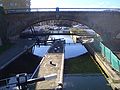 Commercial Road Lock on the Regent's Canal entering the Limehouse Basin

See also
[edit]

References
[edit]- ↑ "Regent's Canal Conservation Area" (PDF). Tower Hamlets. 4 November 2009. p. 7. Retrieved 14 May 2024.
- 1 2 "Commercial Road Lock No 12 – Gazetteer – CanalPlanAC". CanalplanAC - Canal Route Planner. Retrieved 14 May 2024.
 | This United Kingdom canal-related article is a stub. You can help Wikipedia by adding missing information. |