


// Workers AI · dad joke modeWhat did Capps, Alabama say to the bottle? You're capped.
Capps, Alabama | |
|---|---|
  Capps  Capps | |
| Coordinates: 31°29′50″N 85°18′43″W / 31.49722°N 85.31194°W | |
| Country | United States |
| State | Alabama |
| County | Henry |
| Elevation | 423 ft (129 m) |
| Time zone | UTC-6 (Central (CST)) |
| • Summer (DST) | UTC-5 (CDT) |
| Area code | 334 |
| GNIS feature ID | 115606[1] |
Capps, also known as Choctawhatchee, is an unincorporated community in Henry County, Alabama, United States. Capps is located on Alabama State Route 173, 7.2 miles (11.6 km) southeast of Abbeville.
History
[edit]Capps is named after Daniel W. Capps, the community's first postmaster.[2] A post office operated under the name Capps from 1849 to 1972.[3] Capps served as a shipping point for agricultural products between Abbeville and Headland.[4]
References
[edit]- ↑ "Capps". Geographic Names Information System. United States Geological Survey, United States Department of the Interior.
- ↑ Foscue, Virginia (1989). Place Names in Alabama. Tuscaloosa: The University of Alabama Press. p. 28. ISBN 0-8173-0410-X.
- ↑ "Henry County". Jim Forte Postal History. Retrieved August 1, 2015.
- ↑ Milton Whitney; United States. Dept. of Agriculture; United States. Bureau of Soils (1911). Field operations of the Bureau of Soils. Bureau of Soils. p. 485.
Municipalities and communities of Henry County, Alabama, United States | ||
|---|---|---|
| Cities | 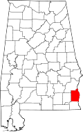 | |
| Towns | ||
| Unincorporated communities | ||
| Footnotes | ‡This populated place also has portions in an adjacent county or counties | |
 | This Henry County, Alabama state location article is a stub. You can help Wikipedia by adding missing information. |