Arrats de devant
| Arrats de devant Petit Arrats | |
|---|---|
 Waterfall, located on the section of river, running through the commune of Saint-Blancard. | |
  Location of Arrats de devant (Occitanie region) | |
 | |
| Physical characteristics | |
| Source | Gascony |
| • location | Betbeze |
| • coordinates | 43°17′18″N 0°34′04″E / 43.28833°N 0.56778°E |
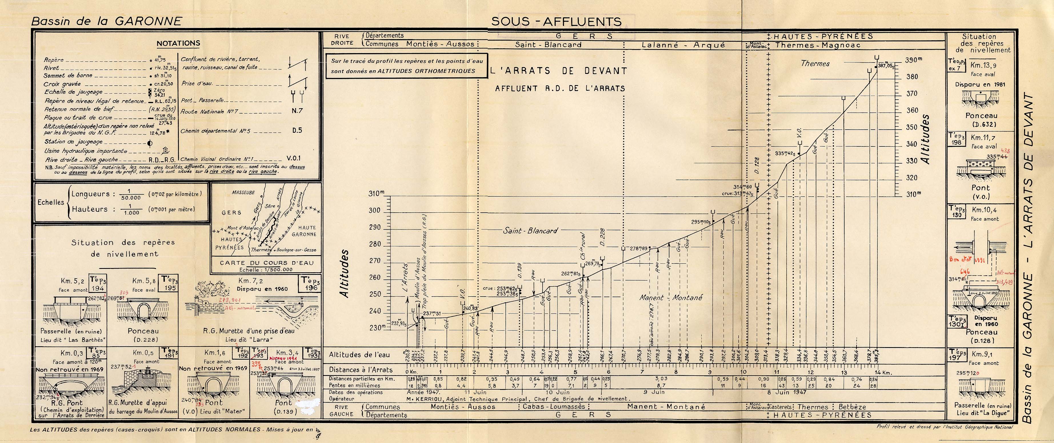
| • elevation | 387.05 m (1,269.8 ft)[1] |
| Mouth | Arrats (Lac de l'Astarac) |
• location | Bézues-Bajon |
• coordinates | 43°22′54″N 0°37′51″E / 43.38167°N 0.63083°E |
• elevation | 237.51 m (779.2 ft)[1] |
| Length | 14 km (8.7 mi) [2] |
| Basin features | |
| Progression | Arrats→ Garonne→ Gironde estuary→ Atlantic Ocean |
| Tributaries | |
| • left |
|
| • right |
|
The Arrats de devant, sometimes called the Petit Arrats (little Arrats), is a river in southern France and a sub-tributary of the Garonne via the Arrats.[2]
Geography
[edit]Measuring 14.1 km (8.8 mi) long,[2] the Arrats de devant originates in the Hautes-Pyrénées department in the commune of Betbeze, starting an elevation of 387.05 m (1,269.8 ft).[1] It flows into the Arrats at the commune of Bézues-Bajon in the Lac de l'Astarac, ending at an elevation of 237.51 m (779.2 ft).[1]
Lac de l'Astarac is formed from two forks, creating a Y-shape. The east fork is the Petit Arrats, while the west fork is formed by the upstream part of the Arrats.
Departments and towns intersected
[edit]Main tributaries
[edit]- (L) Métairie du Bois creek : 1.4 km (0.87 mi)
- (L) Briquet creek : 1.4 km (0.87 mi)
- (R) Gouttillets creek : 1.3 km (0.81 mi)
- (R) Nax creek : 1.5 km (0.93 mi)
(R) right bank; (L) left bank.
Gallery
[edit] Natural log jam on the river destroyed by the February 2021 flood.
 Bridge over the D139.


References
[edit]- 1 2 3 4 "L'Arrats de Devant" (JPG). Institut national de l'information géographique et forestière. June 11, 1947. Archived from the original on December 5, 2024. Retrieved December 4, 2024.
- 1 2 3 4 "Fiche cours d'eau - L'Arrats de devant (O6020610)". Sandre. SandreO6020610. Retrieved 11 February 2014.
Sources
[edit]- French Wikipedia; Arrats de devant, Accessed on December 4, 2024.
Category:Arrats de devant at Wikipedia's sister projects
 Definitions from Wiktionary
 Media from Commons
 Quotations from Wikiquote
 Texts from Wikisource
 Textbooks from Wikibooks
 Resources from Wikiversity