


Sehel Island
.jpg)


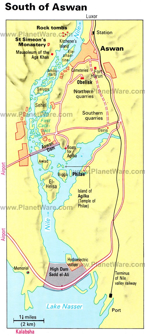
Sehel Island (Ancient Greek: Σῆτις)[1] is located in the Nile, about 2 miles (3.2 km) southwest of Aswan in southern Egypt. It is a large island, and is roughly halfway between the city and the upstream Aswan Low Dam.[2]
Geography
[edit]Sehel Island, spanning 3/4 the width of the Nile, is the primary large island below the Nile's First Cataract and the Aswan Low Dam (1902). Following downriver, the next major islands after Sehel are: Saluga, Ambunarti, Elephantine, and then Kitchener's Island. There are a dozen smaller islands scattered around them.
Archaeological artefacts
[edit]
| |||||||
| sṯt[3] in hieroglyphs | |||||||
|---|---|---|---|---|---|---|---|
| Era: Old Kingdom (2686–2181 BC) | |||||||


| ||||
| sṯt(t)[3][4] in hieroglyphs | ||||
|---|---|---|---|---|


The island was known in ancient tiles as Setet,[5] and there are many archaeological sites, including sacred places, such as the temple of Anuket, the Egyptian water goddess, and goddess of the Nile's cataracts.
Sehel was home to a stone quarry for granite used during various Ancient Egyptian eras, and there are many inscriptions in the island's granite boulders. These inscriptions were usually left by travellers marking either the start or end of their journey to Nubia. There are several famous inscriptions that record ancient historical events. One is the Famine Stela, which is of Greco-Roman origin, but claims to record events from the time of Djoser and Imhotep.
Gallery
[edit] Sehel Inscriptions, in island's granite boulders.
 The Famine Stela, Sehel Island.

.jpg)
References
[edit]- ↑ "TM Places". Trismegistos. Retrieved 2020-06-22.
- ↑ Aswan area map, Planetware.com, web JPEG image: PW: (map shows major islands near Aswan Dam and Aswan High Dam).
- 1 2 Gauthier, Henri (1928). Dictionnaire des Noms Géographiques Contenus dans les Textes Hiéroglyphiques Vol. 5. pp. 94–95.
- ↑ Wallis Budge, E. A. (1920). An Egyptian hieroglyphic dictionary: with an index of English words, king list and geological list with indexes, list of hieroglyphic characters, coptic and semitic alphabets, etc. Vol II. John Murray. p. 1037.
- ↑ "Switching..." www.thaliatook.com. Retrieved 2018-02-24.
External links
[edit]
Islands of Egypt | ||
|---|---|---|
| Nile islands | ||
| Red Sea islands | ||
| Mediterranean Sea islands | ||

| National | |
|---|---|
| Geographic | |

24°03′33″N 32°52′16″E / 24.05917°N 32.87111°E
.png) | This article about subjects relating to ancient Egypt (c. 3150 BC – 30 BC) is a stub. You can help Wikipedia by adding missing information. |
.svg) | This geography of Egypt article is a stub. You can help Wikipedia by adding missing information. |