


// Workers AI · dad joke modeDoes the Allier river go with the flow?
| Allier | |
|---|---|
 Bridge over the Allier in Brioude, Haute-Loire. | |
 | |
 | |
| Native name | Alèir (Occitan) |
| Location | |
| Country | France |
| Physical characteristics | |
| Source | Moure de la Gardille, Margeride |
| • location | Massif Central |
| • coordinates | 44°35′23″N 3°48′04″E / 44.58972°N 3.80111°E |
| • elevation | 1,503 m (4,931 ft) |
| Mouth | |
• location | Loire (bec d'Allier, Cuffy/Gimouille) |
• coordinates | 46°57′34″N 3°4′44″E / 46.95944°N 3.07889°E |
• elevation | 167 m (548 ft) |
| Length | 421 km (262 mi) |
Basin size | 14,350 km2 (5,540 mi2) |
| Discharge | |
| • average | 140 m3/s (4,900 cu ft/s) |
| Basin features | |
| Progression | Loire→ Atlantic Ocean |
The Allier (UK: /ˈælieɪ/ AL-ee-ay,[1] US: /ælˈjeɪ, ɑːlˈjeɪ/ a(h)l-YAY,[2][3] French: [alje] ⓘ; Occitan: Alèir) is a river in central France. It is a left tributary of the Loire. Its source is in the Massif Central, in the Lozère department, east of Mende. It flows generally north. It joins the Loire west of the city of Nevers. It is 421 km (262 mi) long, and has a drainage basin of 14,350 km2 (5,540 mi2).[4]
Departments and towns
[edit]The Allier flows through the following departments, and along the following towns, from source to mouth:
- Lozère: La Bastide-Puylaurent, Langogne;
- Ardèche - the river runs along the border between this department and Lozère;
- Haute-Loire: Monistrol-d'Allier, Langeac, Brioude;
- Puy-de-Dôme: Brassac-les-Mines, Auzat-la-Combelle, Issoire, Cournon-d'Auvergne, Pont-du-Château;
- Allier: Saint-Yorre, Vichy, Varennes-sur-Allier, Moulins, Château-sur-Allier;
- Cher: Mornay-sur-Allier;
- Nièvre.
Tributaries
[edit]The main tributaries of the Allier are:
- Chapeauroux (left side);
- Senouire (right side);
- Alagnon (left side);
- Ance du Sud (left side);
- Couze Pavin (left side);
- Veyre (left side);
- Monne (left side);
- Dore (right side);
- Dolore (left side);
- Morge (left side);
- Sichon (right side);
- Sioule (left side).
Ecology
[edit]
The Allier is one of the rare places in southern Europe where the freshwater grayling (Thymallus thymallus), known in French as ombre des rivières, occurs in a natural habitat.[5]
Grayling like to live in shoals and are sensitive to pollution. In the Allier these fish are more abundant in the stretch between Langogne and Brioude. They are economically important, being appreciated for food and fished for sport.
Gallery
[edit]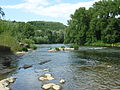 Coudes, Puy-de-Dôme.
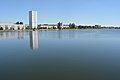 Vichy, Allier.
![Pont Régemortes [fr] in Moulins, Allier.](https://upload.wikimedia.org/wikipedia/commons/thumb/9/9c/Moulins-bruecke-vom-allier.JPG/120px-Moulins-bruecke-vom-allier.JPG) Pont Régemortes in Moulins, Allier.
Pont Régemortes in Moulins, Allier.![The bridge Le Guétin [fr].](https://upload.wikimedia.org/wikipedia/commons/thumb/6/60/Allier_Pont_Canal_LeGu%C3%A9tin.jpg/120px-Allier_Pont_Canal_LeGu%C3%A9tin.jpg) The bridge Le Guétin.
The bridge Le Guétin.

_2022-07-14.JPG)
![Pont Régemortes [fr] in Moulins, Allier.](/everything/wiki/File:Moulins-bruecke-vom-allier.JPG)
![The bridge Le Guétin [fr].](/everything/wiki/File:Allier_Pont_Canal_LeGu%C3%A9tin.jpg)
References
[edit]

- ↑ "Allier". Lexico UK English Dictionary. Oxford University Press. Archived from the original on 2019-12-29.
- ↑ "Allier". Collins English Dictionary. HarperCollins. Retrieved 21 August 2019.
- ↑ "Allier". Merriam-Webster.com Dictionary. Merriam-Webster. OCLC 1032680871. Retrieved 21 August 2019.
- ↑ Sandre. "Fiche cours d'eau (K---0080)".
- ↑ "The grayling zones of rivers and their tributaries" (PDF). Archived from the original (PDF) on 2009-02-07. Retrieved 2009-01-14.
| International | |
|---|---|
| National | |
| Other | |

- Tributaries of the Loire
- Rivers of France
- Allier basin
- Rivers of Allier
- Rivers of Ardèche
- Rivers of Cher (department)
- Rivers of Haute-Loire
- Rivers of Lozère
- Rivers of Nièvre
- Rivers of Puy-de-Dôme
- Rivers of Bourgogne-Franche-Comté
- Rivers of Centre-Val de Loire
- Rivers of Auvergne-Rhône-Alpes
- Rivers of Occitania (administrative region)
- Auvergne-Rhône-Alpes river stubs
- France river stubs
- Bourgogne-Franche-Comté geography stubs
- Centre-Val de Loire geography stubs
- Occitania (administrative region) river stubs