


// Workers AI · dad joke modeWhy did Newark, California go to therapy? It had a new ark to work through.
Newark, California | |
|---|---|
 Silliman Activity and Family Aquatic Center | |
 Flag  Logo | |
 Interactive map of Newark, California | |
  Newark Location within San Francisco Bay Area  Newark Location within California  Newark Location within the United States | |
| Coordinates: 37°32′N 122°2′W / 37.533°N 122.033°W | |
| Country |  United States United States |
| State |  California California |
| County | Alameda |
| Incorporated | September 22, 1955[1] |
| Named after | Newark Castle, Port Glasgow |
| Government | |
| • Mayor | Michael K. Hannon[2] |
| • State Senate | Aisha Wahab (D)[3] |
| • State Assembly | Alex Lee (D)[4] |
| • U. S. Congress | Ro Khanna (D)[5] |
| Area | |
• Total | 13.94 sq mi (36.11 km2) |
| • Land | 13.92 sq mi (36.05 km2) |
| • Water | 0.023 sq mi (0.06 km2) 0.17% |
| Elevation | 20 ft (6.1 m) |
| Population | |
• Total | 47,529 |
| • Density | 3,415/sq mi (1,318/km2) |
| Time zone | UTC−8 (Pacific (PST)) |
| • Summer (DST) | UTC−7 (PDT) |
| ZIP code | 94560 |
| Area code | 510, 341 |
| FIPS code | 06-50916 |
| GNIS feature IDs | 277562, 2411238 |
| Website | www |
Newark (/ˈnjuːərk/ NEW-ərk) is a city in Alameda County, California, United States. It was incorporated as a city in September 1955. Newark is an enclave, surrounded by the city of Fremont. The three cities of Newark, Fremont, and Union City make up the Tri-City Area. Newark's population was 47,529 at the 2020 census[8] making it the third largest city in the US named Newark after Newark, New Jersey, and Newark, Ohio.
Geography
[edit]
The western edge of the city is near the southern end of the San Francisco Bay. State Route 84 runs through the city, and continues as the Dumbarton Bridge to cross the San Francisco Bay to reach Menlo Park. Interstate 880 serves as the eastern boundary with Fremont.
According to the United States Census Bureau, the city has a total area of 13.9 square miles (36 km2), of which 13.9 square miles (36 km2) is land and 0.02 square miles (0.052 km2), comprising 0.17%, is water.
History
[edit]Newark was named after Newark Castle, Port Glasgow, in Scotland by J. Barr Robertson.
Before it was settled by Europeans, Newark was home to the Ohlone Native American Peoples. The first European settlement in the area was by the Spanish missionaries of Mission San José, whose territory covered much of the present-day cities of Newark, Fremont, and Union City. In 1878 land belonging to Washington Township of Alameda County was purchased by The Pacific Land Investment Company and subdivided to form the town of Newark.
In the early 1950s, the amalgamation of towns was increasing in Alameda County. In 1953, residents in the towns surrounding Newark were concerned about being annexed into the nearby city of Hayward, and began plans to incorporate as a single city, eventually becoming Fremont.[9] Driven by their own concerns of being forced to amalgamate into this new city and the resulting changes in zoning, Newark was incorporated in September 1955, before the incorporation of Fremont was completed.[10]
Demographics
[edit]| Census | Pop. | Note | %± |
|---|---|---|---|
| 1880 | 179 | — | |
| 1950 | 1,532 | — | |
| 1960 | 9,884 | 545.2% | |
| 1970 | 27,153 | 174.7% | |
| 1980 | 32,126 | 18.3% | |
| 1990 | 37,861 | 17.9% | |
| 2000 | 42,471 | 12.2% | |
| 2010 | 42,573 | 0.2% | |
| 2020 | 47,529 | 11.6% | |
| U.S. Decennial Census[11] 1860–1870[12][13] 1880-1890[14] 1900[15] 1910[16] 1920[17] 1930[18] 1940[19] 1950[20] 1960[21][22] 1970[23] 1980[24] 1990[25] 2000[26] 2010[27] 2020 | |||
2020 census
[edit]As of the 2020 census, Newark had a population of 47,529 and a population density of 3,414.7 inhabitants per square mile (1,318.4/km2). The age distribution was 20.6% under the age of 18, 7.8% aged 18 to 24, 33.2% aged 25 to 44, 25.0% aged 45 to 64, and 13.3% who were 65 years of age or older. The median age was 36.8 years. For every 100 females, there were 101.4 males, and for every 100 females age 18 and over there were 100.0 males.[28][29]
The Census reported that 99.4% of the population lived in households, 0.6% lived in non-institutionalized group quarters, and 0.0% were institutionalized. In total, 99.9% of residents lived in urban areas and 0.1% lived in rural areas.[28][30]
There were 14,946 households, out of which 38.7% included children under the age of 18, 60.8% were married-couple households, 5.6% were cohabiting couple households, 18.8% had a female householder with no partner present, and 14.8% had a male householder with no partner present. 14.1% of households were one person, and 5.8% were one person aged 65 or older. The average household size was 3.16. There were 11,858 families (79.3% of all households).[28][31]
There were 15,371 housing units at an average density of 1,104.3 units per square mile (426.4 units/km2), of which 14,946 (97.2%) were occupied. Of occupied units, 68.1% were owner-occupied and 31.9% were occupied by renters. The homeowner vacancy rate was 0.7%, and the rental vacancy rate was 3.4%.[28][29]
|
2023 American Community Survey estimates
[edit]In 2023, the US Census Bureau estimated that 43.0% of the population were foreign-born. Of all people aged 5 or older, 42.8% spoke only English at home, 19.1% spoke Spanish, 11.6% spoke other Indo-European languages, 26.1% spoke Asian or Pacific Islander languages, and 0.4% spoke other languages. Of those aged 25 or older, 89.5% were high school graduates and 47.1% had a bachelor's degree.[32]
The median household income was $164,909, and the per capita income was $68,775. About 2.1% of families and 4.2% of the population were below the poverty line.[33]
Politics
[edit]In the state legislature, Newark is in the 10th senatorial district, represented by Democrat Aisha Wahab,[3] and in the 24th Assembly district, represented by Democrat Alex Lee.[4] Federally, Newark is in California's 17th congressional district, represented by Democrat Ro Khanna.[5]
Economy
[edit]Newark's economy is at the edge of Silicon Valley and shares its economic pattern.
Cargill Salt, previously known as Leslie Salt, operates a large salt refinery in Newark, cleaning salt produced in salt evaporation ponds in the San Francisco Bay.[34]
The city houses the NewPark Mall, a super-regional shopping center, with Hot Topic, Box lunch, and a nearby Costco.. A 140,000-square-foot (13,000 m2) addition at NewPark, including restaurants, entertainment and a multiplex movie theater with IMAX, opened in 2015.[35]
The former Sun Microsystems site near I-880, State Route 84 and the Dumbarton Bridge, was purchased by BioMed Realty Trust and is now known as the Pacific Research Center.
In the early to mid-20th century, Newark's economy was based on manufacturing, including: Wedgewood stoves (1910s–1940s);[36][10] A.O. Smith Corporation, followed by National Steel Corporation, glass-lined water heaters (1950s–1970s); Peterbilt trucks (1960s-1980s);[37] and Trailmobile semi-trailers (1965–1975).[38]
Top employers
[edit]According to the city's June 2025 Annual Comprehensive Financial Report,[39] the top employers in the city are:
| # | Employer | # of Employees |
|---|---|---|
| 1 | Lucid Motors | 2,665 |
| 2 | WorldPac | 521 |
| 3 | Amazon Fulfillment Center | 453 |
| 4 | Newark Unified School District | 448 |
| 5 | Costco | 315 |
| 6 | City of Newark | 290 |
| 7 | KNT Manufacturing | 250 |
| 8 | Nordstrom Distribution Center | 230 |
| 9 | Cargill Salt | 202 |
| 10 | SMART Modular Technologies | 139 |
Culture and recreation
[edit]The City of Newark has thirteen parks and sport play facilities,[40] the George M. Silliman Community Activity and Family Aquatic Center (aka the Silliman Center). The Family Aquatic Center portion of the Silliman Center opened in the summer of 2004 and includes a 32,300-square-foot (3,000 m2) indoor swim facility specifically designed for recreation, fitness, and instruction programs for the entire family. The 11,350-square-foot (1,054 m2) Natatorium includes four separate pools, including a 45 ft × 75 ft (14 m × 23 m) Activity Pool; a 245' long Lazy River pool (with a pair of 20' tall, curving water slides); a 4-foot (1.2 m) deep, 4-lane, 25-yard (23 m) Lap Pool; and a 15-person warm-water spa.[41]
Newark also houses a portion of the Don Edwards San Francisco Bay National Wildlife refuge along with the city of Fremont.
Newark also hosts a festival in honor of the city's founding. "Newark Days" is a four-day Festival/Celebration that takes place every September on the Macgregor Soccer fields (adjacent to the Community center on Cedar Boulevard). The City of Newark is also commonly known with their soccer club, 1974 NFC (Newark Football Club).[42]
Transportation
[edit]Newark lies near the intersection of I-880, State Route 84, and the Dumbarton Bridge.[43]
Newark is served by AC Transit bus system. Surrounding Fremont is the access point for most transportation services, including Fremont and Union City BART stations, and ACE and Amtrak trains.
Vision for future rail
[edit]In 2007, the plans for the Dumbarton Rail Corridor envisioned Caltrain building a station in Newark.[44]
Education
[edit]Newark is home to a new campus of Ohlone College, a member of the California Community Colleges system. Other nearby educational centers include the University of Phoenix, ITT Institute, DeVry University, and Unitek College.
Newark has two high schools, Newark Memorial High School and Bridgepoint High School, and one junior high school, Newark Middle School. Bridgepoint High School is an alternative high school on the MacGregor Campus which also houses Newark Adult School. Elementary schools include Kennedy, Coyote Hills (formerly Graham), Lincoln, Schilling, Birch Grove Primary (K-3)(formerly Bunker), and Birch Grove Intermediate (4–6) (formerly Milani) Schools and one private Catholic elementary-8th grade, St. Edward's Catholic School, and previously Musick and Snow School before their clousures.
Climate
[edit]| Climate data for Newark, California | |||||||||||||
|---|---|---|---|---|---|---|---|---|---|---|---|---|---|
| Month | Jan | Feb | Mar | Apr | May | Jun | Jul | Aug | Sep | Oct | Nov | Dec | Year |
| Record high °F (°C) | 74 (23) |
78 (26) |
84 (29) |
92 (33) |
98 (37) |
107 (42) |
105 (41) |
110 (43) |
103 (39) |
96 (36) |
84 (29) |
75 (24) |
107 (42) |
| Mean daily maximum °F (°C) | 57.3 (14.1) |
60.8 (16.0) |
63.5 (17.5) |
66.6 (19.2) |
70.2 (21.2) |
74.2 (23.4) |
76.7 (24.8) |
77.0 (25.0) |
77.3 (25.2) |
72.8 (22.7) |
64.6 (18.1) |
58.0 (14.4) |
68.2 (20.1) |
| Daily mean °F (°C) | 49.0 (9.4) |
52.2 (11.2) |
54.7 (12.6) |
57.4 (14.1) |
60.9 (16.1) |
64.5 (18.1) |
66.6 (19.2) |
67.0 (19.4) |
66.6 (19.2) |
62.6 (17.0) |
55.4 (13.0) |
49.6 (9.8) |
58.9 (14.9) |
| Mean daily minimum °F (°C) | 40.6 (4.8) |
43.7 (6.5) |
45.9 (7.7) |
48.2 (9.0) |
51.7 (10.9) |
54.9 (12.7) |
56.4 (13.6) |
57.0 (13.9) |
56.0 (13.3) |
52.3 (11.3) |
46.2 (7.9) |
41.3 (5.2) |
49.5 (9.7) |
| Record low °F (°C) | 22 (−6) |
26 (−3) |
25 (−4) |
32 (0) |
35 (2) |
41 (5) |
44 (7) |
41 (5) |
40 (4) |
33 (1) |
26 (−3) |
21 (−6) |
21 (−6) |
| Average precipitation inches (mm) | 2.96 (75) |
2.52 (64) |
2.10 (53) |
1.02 (26) |
0.41 (10) |
0.10 (2.5) |
0.02 (0.51) |
0.05 (1.3) |
0.13 (3.3) |
0.78 (20) |
1.78 (45) |
2.46 (62) |
14.31 (363) |
| Average precipitation days (≥ 0.01 in) | 10 | 8 | 8 | 5 | 3 | 1 | 0 | 0 | 1 | 3 | 7 | 9 | 56 |
| Source: Western Regional Climate Center[45] | |||||||||||||
Notable people
[edit]- Terry Alderete, businesswoman[46]
- Bayley, professional wrestler
- Larry Bettencourt, NFL player for the Green Bay Packers, MLB player for the St. Louis Browns
- Paul Bostaph, drummer
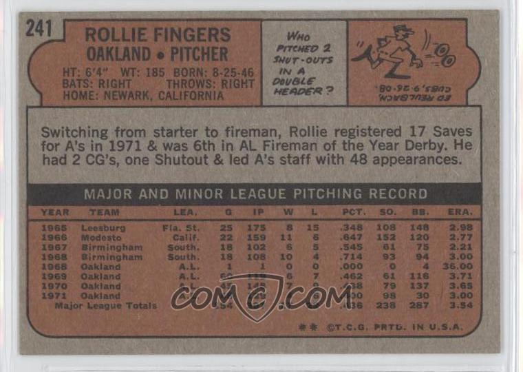
- Rollie Fingers, MLB Hall of Fame relief pitcher[47]
- Chris Flexen, pitcher, Seattle Mariners
- Steven J. Lopes, Bishop of the Personal Ordinariate of the Chair of Saint Peter
- Joey Lucchesi, pitcher, San Diego Padres
- Freddie Muller, infielder, Boston Red Sox[48]
- Rocky Pamplin,[49] author,[50] former football player,[51] member of the Beach Boys[citation needed]
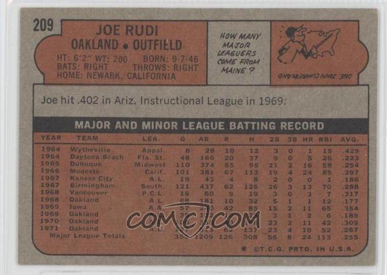
- Joe Rudi, MLB player[52]
- Ron Thompson, guitarist[53]
- Christopher Titus, comedian[54]
- Bill Walsh lived in Newark from 1957 to 1960 while working at Washington High School in Fremont.[55]
- Elaine Welteroth, American journalist and former Editor-in-Chief of Teen Vogue
References
[edit]- ↑ "California Cities by Incorporation Date". California Association of Local Agency Formation Commissions. Archived from the original (Word) on November 3, 2014. Retrieved March 27, 2013.
- ↑ "Mayor Michael K. Hannon". City of Newark. Retrieved September 4, 2023.
- 1 2 "Senators". State of California. Retrieved March 18, 2013.
- 1 2 "Members Assembly". State of California. Retrieved March 18, 2013.
- 1 2 "California's 17th Congressional District - Representatives & District Map". Civic Impulse, LLC. Retrieved March 13, 2013.
- ↑ "2019 U.S. Gazetteer Files". United States Census Bureau. Retrieved July 1, 2020.
- ↑ "Newark". Geographic Names Information System. United States Geological Survey, United States Department of the Interior.
- 1 2 "U.S. Census Bureau QuickFacts: Newark city, California". United States Census Bureau. Retrieved September 26, 2021.
- ↑ "Archived copy". Archived from the original on September 29, 2011. Retrieved May 5, 2011.
{{cite web}}: CS1 maint: archived copy as title (link) - 1 2 "Newark's Roots". City of Newark official web site. Retrieved June 27, 2023.
- ↑ "Decennial Census by Decade". United States Census Bureau.
- ↑ "1870 Census of Population - Population of Civil Divisions less than Counties - California - Almeda County to Sutter County" (PDF). United States Census Bureau. Archived from the original (PDF) on January 26, 2025 – via Wayback Machine.
- ↑ "1870 Census of Population - Population of Civil Divisions less than Counties - California - Tehama County to Yuba County" (PDF). United States Census Bureau. Archived from the original (PDF) on February 2, 2025 – via Wayback Machine.
- ↑ "1890 Census of Population - Population of California by Minor Civil Divisions" (PDF). United States Census Bureau. Archived from the original (PDF) on March 11, 2025 – via Wayback Machine.
- ↑ "1900 Census of Population - Population of California by Counties and Minor Civil Divisions" (PDF). United States Census Bureau. Archived from the original (PDF) on March 4, 2025 – via Wayback Machine.
- ↑ "1910 Census of Population - Supplement for California" (PDF). United States Census Bureau. Archived from the original (PDF) on April 4, 2025. Retrieved February 4, 2025 – via Wayback Machine.
- ↑ "1920 Census of Population - Number of Inhabitants - California" (PDF). United States Census Bureau. Archived from the original (PDF) on April 28, 2025 – via Wayback Machine.
- ↑ "1930 Census of Population - Number and Distribution of Inhabitants - California" (PDF). United States Census Bureau. Archived from the original (PDF) on March 17, 2025 – via Wayback Machine.
- ↑ "1940 Census of Population - Number of Inhabitants - California" (PDF). United States Census Bureau. Archived from the original (PDF) on January 26, 2025 – via Wayback Machine.
- ↑ "1950 Census of Population - Number of Inhabitants - California" (PDF). United States Census Bureau. Archived from the original (PDF) on February 19, 2025 – via Wayback Machine.
- ↑ "1960 Census of Population - Number of Inhabitants - California" (PDF). United States Census Bureau. Archived from the original (PDF) on March 22, 2025 – via Wayback Machine.
- ↑ "1960 Census of Population - General population Characteristics - California" (PDF). United States Census Bureau. Archived from the original (PDF) on March 22, 2025 – via Wayback Machine.
- ↑ "1970 Census of Population - Number of Inhabitants - California" (PDF). United States Census Bureau. Archived from the original (PDF) on February 26, 2025 – via Wayback Machine.
- ↑ "1980 Census of Population - Number of Inhabitants - California" (PDF). United States Census Bureau. Archived from the original (PDF) on January 26, 2025 – via Wayback Machine.
- ↑ "1990 Census of Population - Population and Housing Unit Counts - California" (PDF). United States Census Bureau. Archived from the original (PDF) on January 26, 2025 – via Wayback Machine.
- ↑ "2000 Census of Population - Population and Housing Unit Counts - California" (PDF). United States Census Bureau. Archived from the original (PDF) on March 22, 2025 – via Wayback Machine.
- ↑ "2010 Census of Population - Population and Housing Unit Counts - California" (PDF). United States Census Bureau. Archived from the original (PDF) on March 28, 2025 – via Wayback Machine.
- 1 2 3 4 5 "2020 Decennial Census Demographic Profile (DP1)". United States Census Bureau. 2021. Retrieved April 18, 2026.
- 1 2 3 "2020 Decennial Census Redistricting Data (Public Law 94-171)". United States Census Bureau. 2021. Retrieved April 18, 2026.
- ↑ "2020 Decennial Census Demographic and Housing Characteristics (DHC)". United States Census Bureau. 2023. Retrieved April 18, 2026.
- ↑ "Newark city, California; P16: Household Type - 2020 Census of Population and Housing". US Census Bureau. Retrieved March 24, 2025.
- ↑ "Newark city, California; CP02: Comparative Social Characteristics in the United States - 2023 ACS 5-Year Estimates Comparison Profiles". US Census Bureau. Retrieved March 26, 2025.
- ↑ "Newark city, California; DP03: Selected Economic Characteristics - 2023 ACS 5-Year Estimates Comparison Profiles". US Census Bureau. Retrieved March 26, 2025.
- ↑ "Cargill Salt - San Francisco Bay: About Us". Archived from the original on July 16, 2011. Retrieved August 21, 2011.
- ↑ "History". Contracostatimes.com. April 2014. Retrieved May 4, 2014.
- ↑ "Archived copy". Archived from the original on August 19, 2018. Retrieved December 17, 2017.
{{cite web}}: CS1 maint: archived copy as title (link) - ↑ "History". Peterbilt web site. Archived from the original on February 9, 2013. Retrieved May 29, 2010.
- ↑ "History". Coachbuilt.com. Retrieved November 4, 2013.
- ↑ Lee, Krysten (December 19, 2025). Financial Statements Year Ended June 30, 2025: City of Newark (Report). Newark, CA. p. 149. Retrieved July 20, 2026.
- ↑ "Recreation & Community Services: Parks". City of Newark web site. Archived from the original on May 16, 2010. Retrieved May 29, 2010.
- ↑ "Silliman Center Official" (PDF). Newark.org. Retrieved April 17, 2008.
- ↑ "Historic Newark Days". Newark Days Inc. web site. Retrieved May 29, 2010.
- ↑ "google map". Maps.google.com. Retrieved April 17, 2008.
- ↑ "Dumbarton Rail Corridor". San Mateo County Transportation Authority. Archived from the original on April 17, 2012. Retrieved January 24, 2007.
- ↑ "General Climate Summary Tables - NEWARK, CALIFORNIA". Western Regional Climate Center. Retrieved May 31, 2024.
- ↑ "Terry Alderete". Hispanic Community Affairs Council. Archived from the original on December 12, 2013. Retrieved June 3, 2012.
- ↑ "Photographic image : Rollie Fingers card" (JPG). Images.checkoutmycards.com. Retrieved July 21, 2020.
- ↑ "Freddie Muller Stats". Baseball-Reference.com. Retrieved July 21, 2020.
- ↑ Argus, Saturday, January 23, 1965, Page 4
- ↑ Pamplin, Rushton "Rocky"; Hamady, Ron (July 22, 2018). The Beach Boys' Endless Wave: Inside America's Band. Westcom Press, LLC. ISBN 978-1938620225.
- ↑ "Rocky Pamplin, 1968-69 | UO Athletics | Oregon Digital". Oregondigital.org. Retrieved July 21, 2020.
- ↑ "Photographic image : Joe Rudi card" (JPG). Images.checkoutmycards.com. Retrieved July 21, 2020.
- ↑ "Bay Area blues guitar legend Ron Thompson dies at age 66". Mercurynews.com. February 19, 2020. Retrieved July 21, 2020.
- ↑ "Christopher Titus". Tv.com. Archived from the original on September 10, 2017. Retrieved July 21, 2020.
- ↑ The Genius: How Bill Walsh Reinvented Football and Created an NFL Dynasty by David Harris
External links
[edit]

- Official website

- Fremont Macaroni Kid Free family resource with local events and more in Newark, Fremont and Union City.
- Alameda County Library, Newark Branch[permanent dead link]
- Newark Library Blog
- Newark Unified School District Archived February 9, 2009, at the Wayback Machine
- U.S. Geological Survey Geographic Names Information System: Newark, California
| Bodies of water |
|  | |||||||||||
|---|---|---|---|---|---|---|---|---|---|---|---|---|---|
| Counties | |||||||||||||
| Cities and towns |
| ||||||||||||
| CDPs over 10k | |||||||||||||
| Sub-regions | |||||||||||||
| Other | |||||||||||||
Municipalities and communities of Alameda County, California, United States | ||
|---|---|---|
| Cities |  | |
| Census-designated places | ||
| Unincorporated communities | ||
| Annexed communities | ||
| Former townships | ||
| Former communities | ||
| International | |
|---|---|
| National | |
| Geographic | |
| Other | |