


// Workers AI · dad joke modeWhat did Mahavelona say to its friend? "Rock" on.
Mahavelona | |
|---|---|
 Foulpointe | |
| Nickname: Foulpointe | |
  Mahavelona Location in Madagascar | |
| Coordinates: 17°41′10″S 49°31′6″E / 17.68611°S 49.51833°E | |
| Country |  Madagascar Madagascar |
| Region | Atsinanana |
| District | Toamasina II |
| Government | |
| • Mayor | Tody Andriamaharo Lalatiana Jaona |
| Area | |
• Total | 400 km2 (150 sq mi) |
| Elevation | 9 m (30 ft) |
| Population (2002) | |
• Total | 13 031 |
| Time zone | UTC4 (EAT) |
| Postal code | 502 |
Mahavelona (commonly called Foulpointe), is a town in the district of Toamasina II, in the region of Atsinanana, on the northern part of the east coast of Madagascar.
Geography
[edit]It is situated at the coast of the Indian Ocean south of the mouth of the Onibe River. The town is located at 60 km[3] north of Toamasina on the RN 5 between Toamasina and Maroantsetra. There is a reef around 150 metres out to sea which prevents waves hitting the beach; the waters by the shoreline are completely calm as a result.
Rivers
[edit]Economy
[edit]Its economy is based on tourism.
Administration
[edit]Eleven Fokontany (villages) are part of this municipality : Foulpointe, Saranaina, Antenina, Vohitamboro, Antaratasy, Marofarihy, Bongabe, Ambohimarina, Morarano, Ambohimanarivo and Ambodivoarabe.[5]
International relations
[edit]Foulpointe is twinned with:

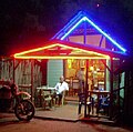 Nightlife
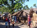 Main road
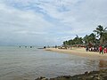 View of beach
 Bungalow at Manda beach
 Beach of Foulpointe
 Manda Fort
 Satellite image


References
[edit]- ↑ PCD Foulepointe
- ↑ Estimated based on DEM data from Shuttle Radar Topography Mission
- ↑ La Gazette de la Grande Ile - 14 May 2013
- ↑ Eaux et hydrographie
- ↑ PCD Foulepointe
- ↑ Ambassade de France

Capital: Toamasina | ||
| Antanambao Manampotsy - 507 |  | |
| Mahanoro - 510 | ||
| Marolambo - 513 | ||
| Toamasina I - 501 | ||
| Toamasina II - 502 | ||
| Vatomandry - 517 | ||
| Vohabinany (Brickaville) - 508 | ||
7 districts; 75 communes | ||
 | This Atsimo-Atsinanana location article is a stub. You can help Wikipedia by adding missing information. |