


// Workers AI · dad joke modeWhat did Channarayapatna say to its neighbor? "Patna" be friends?
Channarayapatna | |
|---|---|
Town | |
 | |
  Channarayapatna Location in Karnataka, India | |
| Coordinates: 12°54′07″N 76°21′50″E / 12.902°N 76.364°E | |
| Country |  India India |
| State | Karnataka |
| District | Hassan |
| Government | |
| • Body | Town municipal council |
| Area | |
• Town | 10.50 km2 (4.05 sq mi) |
| • Rural | 1,063.86 km2 (410.76 sq mi) |
| Elevation | 827 m (2,713 ft) |
| Population (2011)[1] | |
• Town | 40,417 |
| • Rank | 3rd in Hassan district |
| • Density | 3,849/km2 (9,969/sq mi) |
| • Rural | 241,006 |
| Languages | |
| • Official | Kannada |
| Time zone | UTC+5:30 (Indian Standard Time) |
| Postal Index Number (PIN) | 573116, 573225 |
| Telephone code | 08176 |
| Vehicle registration | KA-13 |
| Website | www |
Channarāyapatna or Channarāyapattana is a town and Taluk headquarters in Hassan district of Karnataka, India. It lies on the Bangalore-Mangalore National Highway-75 in Karnataka, India. Jain pilgrimage Shravanabelagola is a famous site in the taluk. Channarayapatna has major railway connection from Bangalore to Mangalore, Karwar, and Mysore.
Geography
[edit]Channarayapatna is located at 12°54′N 76°23′E / 12.90°N 76.39°E.[2] It has an average elevation of 845 metres (2716 ft).
Located within Channarayapatna is Bagur Navile Tunnel, the longest water tunnel in India.
Demographics
[edit]As of 2011 India census, Channarayapatna has a population of 279,798. Males constitute 51% of the population and females 49%. Channarayapatna has an average literacy rate of 73%, higher than the national average of 59.5%; with male literacy of 78% and female literacy of 68%. 11% of the population is under 6 years of age.[3]
Administration
[edit]Taluk
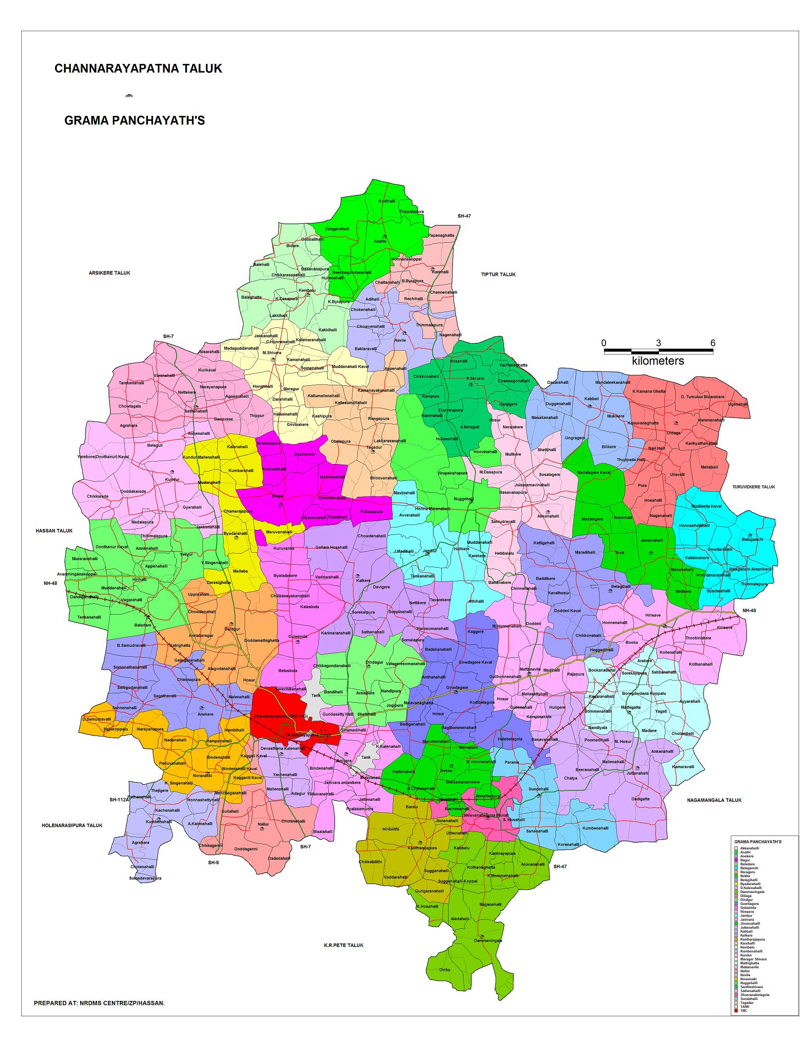
[edit]Channarayapatna Taluk is one of the eight taluks in Hassan district of Karnataka state. There are 40 panchayat villages in Channarayapatna Taluk,[4][5] for 407 villages.[6]
Economy
[edit]Agriculture is the major economic activity. Sugarcane and coconut are the leading commercial crops, while food crops include ragi, Potato, sunflower, and paddy.[7] The taluk also has mineral reserves, such as chromite.[7]
Gallery
[edit] Map of Channarayapatna Taluk as per 2001 Census
 Map of Channarayapatna Taluk as per 2001 Census
 Positioning of Hassan district in Karnataka
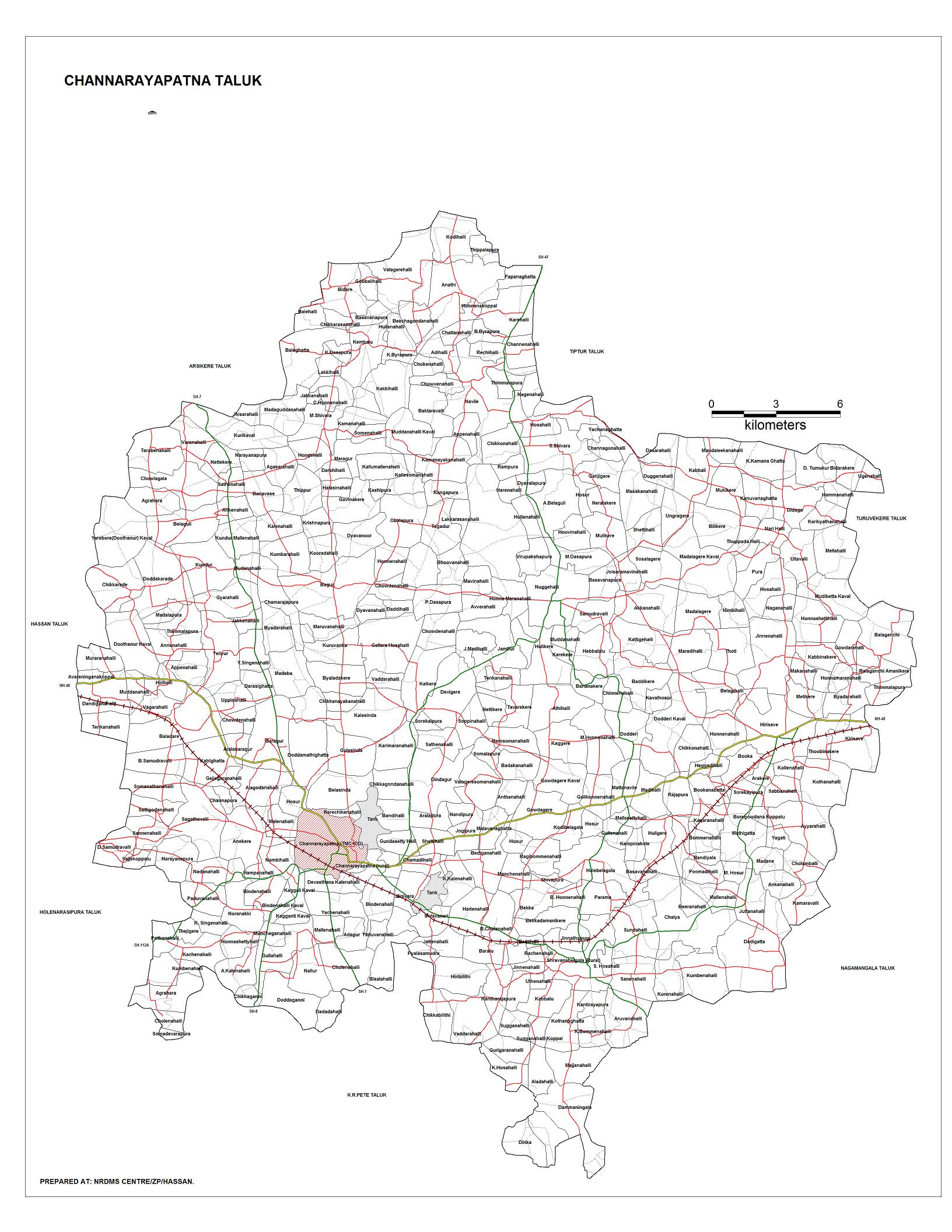
 Village map of Channarayapatna Taluk
 Hobli map of Hassan district
 Hobli and village map of Shravanabelagola Assembly constituency, Channarayapatna Taluk
 Village map of Shravanabelagola Assembly constituency, Channarayapatna Taluk
 Grama panchayat and village map of Channarayapatna Taluk
 Tourism map of Channarayapatna Taluk
 Channarayapatna Taluk - hobli and village map
 Channarayapatna Taluk - grama panchayat and village map
 Channarayapatna Taluk map about fluoride content in DWS


Notable people
[edit]- S. L. Bhyrappa, novelist and professor
- Nanditha, playback singer
- C. N. Manjunath, cardiologist
- H. C. Srikantaiah, former minister and member of Parliament
See also
[edit]References
[edit]- ↑ "Census Data Handbook Hassan 2011" (PDF). Retrieved 28 July 2023.
- ↑ "Maps, Weather, and Airports for Channarayapatna, India". fallingrain.com. Retrieved 6 October 2017.
- ↑ "Census of India 2001: Data from the 2001 Census, including cities, villages and towns (Provisional)". Census Commission of India. Archived from the original on 16 June 2004. Retrieved 1 November 2008.
- ↑ "Reports of National Panchayat Directory: List of Census Villages mapped for: Village Panchayat Names of Channarayapatna, Hassan, Karnataka". Archived from the original on 10 February 2013.
- ↑ "Map: Gram panchayats in Channarayapatna Taluk".
- ↑ "Channarayapatna Taluk: Hobli-wise, VA Circle-wise Villages" (PDF).
- 1 2 "Channarayapatna Taluk Industrial Development Plan". Karnataka Department of Industries and Commerce. Archived from the original (DOC) on 28 October 2014. Retrieved 20 April 2013.

External links
[edit]- NRDMS Centre/ZP/Hassan. "Map: Channarayapatna Taluk". Hassan district.
 | This article related to a location in Hassan district, Karnataka, India is a stub. You can help Wikipedia by adding missing information. |